Dec
8
12:00 PM12:00

Dec 8. (Non AGS Event) Reflections and Roasting of Dr. Jack Sharp

This fall is Dr. Jack Sharp's last semester to teach Hydrogeology at UT, and we would like to celebrate his spectacular career. 

Join us December 8 (Friday) at the Hydro Brown Bag seminar at the UT Jackson School of Geosciences and/or the BBQ Reception at the Pierce home to share exciting thoughts and reflections on our experiences with Jack. 

Jack sharp.jpg

Hydro Brown Bag Seminar: Reflections and Roasting of Dr. Sharp

Where: UT campus, JGB room 3.222

When: December 8, 12:00 – 1:00

BBQ Reception

Where: Pierce home, 5903 Deep Spring Cove, Austin, TX

When: December 8, 4:00 – 9:00 PM

RSVP through Evite

View Event →
Dec
4
6:30 PM18:30

Dec. 4: The Global Energy Scene: A Few Things You Might Not Read in the Times

The Global Energy Scene: A Few Things You Might Not Read in the Times

Scott W. Tinker

Over the past few decades, a story of “good” and “bad” energy has evolved: renewable good, fossil and nuclear bad. Schoolkids are taught “facts” about energy that often violate economic and even physical principles. Passionate evangelists, Hollywood actors, activist investors, and even national newspapers present slanted “ideal world” scenarios. As the United States considers its position in energy—from climate and carbon, to poverty and immigration, to renewable energy and reregulation of electricity markets—it is vital to understand the facts, real costs and benefits, and global implications of various policies in order to minimize politics and maximize lasting impact. I’ll review a few global-energy realities that you are unlikely to read in the Times, and pose a few questions whose answers might challenge what you think. As Mark Twain is credited with saying, “It ain't what you don't know that gets you into trouble. It's what you know for sure that just ain't so.”

articleTinker.jpg

Biography
Dr. Scott W. Tinker is director of the Bureau of Economic Geology, the State Geologist of Texas, a professor holding the Allday Endowed Chair and acting Associate Dean of Research in the Jackson School of Geosciences at The University of Texas at Austin. Scott is past president of the American Association of Petroleum Geologists, the Association of American State Geologists, the Gulf Coast Association of Geological Societies, and the American Geosciences Institute. Scott is a Halbouty Leadership Medalist, a Boyd Medalist, and a Fellow of the Geological Society of America. He has given over 650 keynote and invited lectures to government, industry, academic, and general audiences, and visited nearly 60 countries. Tinker serves on many private, public, academic, and government boards and advisory councils and co-produced and is featured in the award-winning energy documentary film, Switch, which is on thousands of college campuses and has been seen by over 15 million people. He is working on another film project, Switch ON, focused on energy poverty.

View Event →
Nov
18
9:00 AM09:00

AGS Field Trip: Albian Rudist buildup

Field trip to Lake Georgetown spillway--Albian Rudist buildup

The fieldtrip participants will meet Saturday, November 18 at 9am at the small parking lot outside the entrance gate to the Corps of Engineers Cedar Breaks Park on the south side of Lake Georgetown. Cost per participant is $10 and can be paid on site. Bring field shoes, hat, sunscreen, and water; we will provide a printed field guide. Rest rooms are available in the park but not at the spillway. We will spend at least three hours on the excellent exposures of Albian rudist buildups in the spillway, but there is more of the Edwards/Comanche Peak section exposed to explore on your own.

Please contact Charlotte  Sullivan at: charlotte.sullivan(at)pnnl.gov


Exposures of Cretaceous carbonates at the Lake Georgetown spillway, Williamson County, Texas provide a rare three dimensional view of vertical and lateral changes in Upper Albian rudist communities. 

Exposures of Cretaceous carbonates at the Lake Georgetown spillway, Williamson County, Texas provide a rare three dimensional view of vertical and lateral changes in Upper Albian rudist communities. 

SATELLITE MAP GEORGETOWN.JPG
PARKING LAKE GEORGETOWN.jpg
View Event →
Nov
6
6:30 PM18:30

Nov. 6: Systems Thinking for Macroeconomic Modeling: Energy, Debt, Dynamics, and Economic “Structure”

Systems Thinking for Macroeconomic Modeling: Energy, Debt, Dynamics, and Economic “Structure”

Carey W. King

Abstract

Macroeconomic modeling needs to consider a wide range of economic factors (employment, wages, economic output, capital, debt, income distribution) and physical factors (population, rate of energy consumption, capital). Most economic models focus on the former factors much more than the latter.  The Long-term models also need to consider dynamics that have the ability to understand how the rate of change in the energy system interacts with the rest of the economy.  In this talk, Dr. King discusses data and analysis that provide insight into the long-term (100+ years) changes in size and structure of the world and U.S. economy in the context of the size of the energy system.  This topic has implications for modeling a transition to a low-carbon economy, a task for which many mainstream economic models (e.g., general equilibrium models) are ill-equipped.


Bio

Dr. Carey W King performs interdisciplinary research related to how energy systems interact within the economy and environment as well as how our policy and social systems can make decisions and tradeoffs among these often competing factors. The past performance of our energy systems is no guarantee of future returns, yet we must understand the development of past energy systems.  Carey’s research goals center on rigorous interpretations of the past to determine the most probable future energy pathways.

Carey is  Research Scientist at The University of Texas at Austin and Assistant Director at the Energy Institute. He also has appointments with the  Center for International Energy and Environmental Policy within the Jackson School of Geosciences and the McCombs School of Business. He has both a B.S. with high honors and Ph.D. in Mechanical Engineering from the University of Texas at Austin. He has published technical articles in the academic journals Environmental Science and Technology, Environmental Research Letters, Nature Geoscience, Energy Policy, Sustainability, and Ecology and Society. He has also written commentary for American Scientist and Earthmagazines as well as major newspapers such as the Dallas Morning News, Houston Chronicle, and Austin American-Statesman. Dr. King has several patents as former Director for Scientific Research of Uni-Pixel Displays, Inc.

View Event →
Oct
24
9:00 AM09:00

Core Workshop: Shelf-to-Basin Architecture, Depositional Systems, and Facies Variability of the Southern Eastern Shelf of the Permian Basin

Presented by The University of Texas at Austin, Bureau of Economic Geology: State of Texas Advanced Oil and Gas Resource Recovery (STARR) Program

Sponsored by the Austin Geological Society

October 24, 2017 9:00 a.m. - 3:00 p.m.

Location: Austin Core Research Center, 10100 Burnet Road, Austin, Texas 78758; (512) 471-1534

Registration: Please contact Sigrid Clift at sigrid.clift@beg.utexas.edu; Limited to 30 participants; Registration fee: $30.00 (Includes morning refreshments and lunch plus presentations on CD and handouts, but not $3 parking fee).

This all-day workshop offers an in-depth overview of shelf, shelf-edge, and slope depositional facies characteristics, stratigraphic variations, and sedimentation trends of the Missourian Canyon Group and Virgilian–Wolfcampian Cisco Group across the southern Eastern Shelf and the adjacent Midland Basin. Regional depositional features of equivalent strata of the northern half of the Eastern Shelf are well documented in the works of Frank Brown and others. However, the facies architecture of the southern half of this major petroleum province previously had been only incompletely examined. This study is based on detailed analysis of more than 2,200 well logs and approximately 10 cores within a 19-county area of West Texas. Attendees can get a hands-on view of key cores with a detailed review of depositional environments from source to sink—fluvial incised valley fill, shelf, shelf edge, slope, and slope-to-basin-floor transition. Core descriptions, cross sections, and lithofacies maps document temporal and spatial variations in progradational sediment wedges and indicate that significant volumes of sediments were delivered into the Midland Basin where a thick succession of both siliciclastic and carbonate reservoirs offers numerous opportunities for oil and gas production.

Click here for a PDF flyer

Presenters:

Tucker F. Hentz, William A. Ambrose, Robert W. Baumgardner, and Fritz Palacios

Isochore map of the Wolfcampian upper Cisco Group showing location of wells used in the study. Thickest strata coincide with a depocenter of much-thickened slope systems comprising siliciclastic and carbonate debris-flow deposits and thick sections …

Isochore map of the Wolfcampian upper Cisco Group showing location of wells used in the study. Thickest strata coincide with a depocenter of much-thickened slope systems comprising siliciclastic and carbonate debris-flow deposits and thick sections of slope mudrock. Slope sandstones and limestones are among the most productive facies of the southern Eastern Shelf.


View Event →
Oct
2
7:00 PM19:00

Oct 2. AGS Meeting: Geology at the Crossroads--Big Bend Ranch State Park

Geology at the Cross Roads: Big Bend Ranch State Park: Geology, Landscape, Culture, History

by Blaine R. Hall, TPWD, Ret.

Big Bend Ranch State Park (BBRSP), is the largest of the Texas State Parks covering an area of over 300,000 acres (~1200 square kilometers). The scenery is magnificent and the landscape varies from river lowlands, through deep canyons, across high plateaus, and up steep mountains. Ultimately all of this is controlled by the character and variety of the underlying geology and the processes that created it over millions of years.

But why a Crossroads of Geology?   

Because, the park’s southern boundary follows the Rio Grande from about 10 miles below Presidio through a series of Basin and Range grabens for some 40 miles down-river to Lajitas at the northwest corner of Big Bend National Park. Extensive Cenozoic-age volcanics and intrusives make up the Bofecillos Mountains in the central part of the Park, while the Solitario Dome covers the northeastern corner where early Cretaceous-age limestone mark the flank of the dome and Paleozoic-age chert, sandstone, limestone, novaculite, and shale are exposed in its core.  And finally, in southeastern BBRSP early Cretaceous-age shale, marl, and limestone are exposed along the Fresno-Terlingua Monocline.

Furthermore, four of the major orogenic events that mark the development of North America converge in BBRSP. 1) The Ouachita/Marathon foldbelt extends through the Marathon Basin and can be seen in the interior of the Solitario Dome, where exceptional exposures of highly deformed Siluro-Devonian Caballos Novaculite occur. 2) The Laramide foldbelt is also represented in the Park, particularly where the lower Cretaceous Santa Elena, Del Rio, and Buda Formations are asymmetrically folded along the Fresno-Terlingua monocline. 3) Undoubtedly, the most dramatic geological event represented in the Park is the mid-Cenozoic volcanism that built up the Bofecillos Mountains as part of the very extensive Trans-Pecos volcanic province. 4) And finally, along the south edge of BBRSP, the route of the Rio Grande follows Basin and Range age sediment-filled grabens, marked by long, continuous normal to oblique slip faults exposed along very prominent fault scarps.

And Not the Least, the geology and climate have determined the character of the landscape, which in turn greatly influenced the cultural development of the area, and the cultural development through time determines the history of the region.

So, come on out to Big Bend Ranch State Park and watch for the evidence of all four events. Revive your appreciation for the geological enormity of time and scale and the resulting variety of landscape and scenic beauty, both natural and historical, here at the Crossroads.


Figure illustrating the geologic crossroads of BBRSP. Figure from TPWD.

Figure illustrating the geologic crossroads of BBRSP. Figure from TPWD.

Deformation associated with the final stages of the formation of Pangea.

Deformation associated with the final stages of the formation of Pangea.

Biography:

hall_for_web.jpg

Blaine Hall joined Texas Parks and Wildlife in 2010 as an Interpretive Ranger at Big Bend Ranch State Park where he used a hands-on approach in explaining the natural and cultural history of the park. In particular, he helped visitors understand the geology of the park, how the geology controls the development of the park’s landscape, and how the landscape has affected the cultural and historical development of the park. He was uniquely suited for this position because he was able to utilize his wide ranging industry experience, substantial teaching experience, and strong academic background. Blaine completed his B.S. in Geology at UT El Paso, received his M.Sc. in Geological Oceanography from Dalhousie University, and carried out research in marine geology and geophysics while at Lamont-Doherty Earth Observatory of Columbia University. His industry experience began with Superior Oil in minerals exploration for Proterozoic placer gold (South African type) and Kimberlites (Diamonds) in the Rockies, Canada, Kansas, and Arkansas. He then shifted to petroleum, beginning with studies of heavy oil reservoirs in California for Mobil Oil and continued with exploration and production programs in southern South America for Mobil while based in Buenos Aires. He went back to Argentina for Parker and Parsley and consequently, Pioneer Natural Resources. After leaving industry, Blaine returned to his native West Texas and spent the next ten years teaching Geology and Mathematics at Sul Ross State University. While at Sul Ross, he was also very active with the Chihuahuan Desert Research Institute where he developed a permanent exhibit on the geology of the surrounding Davis Mountains and presented workshops for teachers and many other youth and continuing education programs.

Since his retirement from TPWD in 2015, Blaine, now residing in Fort Davis, has continued studying the geology of Big Bend Ranch State Park and guiding the work of others there. He is helping direct the thesis research of Master’s students from Sul Ross State University on differing aspects of the Cenozoic volcanism and tectonics in the park, as well as, special projects for undergraduate McNair Scholars. Blaine is also actively involved with UT Austin faculty and staff in studies of the lower Paleozoic units now exposed in the core of the Solitario, an uplifted and eroded intrusive dome in the park.       

View Event →
Sep
15
to Sep 17

Texas Hydro Geo Workshop (Non AGS event)

September 15-17, 2017

Cave Without a Name, 325 Kruetzberg Road Boerne, Texas

Join us in the field for a weekend of learning and fun with leading researchers and practitioners from across the nation. More than 30 modules will be offered including: 

  • Stream Gauging
  • Water Level Measurements
  • Data Collection
  • Drilling Demonstrations
  • Tracer Testing
  • Karst Feature Evaluation
  • Surface & Borehole Geophysical Surveys
  • Field Instrument Use

More information can be found here: http://caves.org/grotto/bexargrotto/HydroGeo/

TXHGW Event Flyer 2017.jpg
View Event →
Sep
11
6:00 PM18:00

AGS Annual Ethics Training for 2017

Austin Geological Society Annual Ethics Training for 2017

Presented by Will Boettner, P.G. (AGS President)

All licensed geoscientists in the State of Texas are required to complete annual ethics training as part of their Continuing Professional Development. Given that all or most of the practicing geoscientists in Texas are honorable and dedicated at their profession, the question arises of what exactly are ethics in geoscience practice, what purpose do they truly serve and why are they required.

Making ethical decisions about geoscience serves to protect the public we serve, society in general, and protects the good name of the geoscience profession. Working with a Code of Conduct standardizes expectations and actions of practicing geoscientists in a manner that is dependable and reliable for society at large. Approaches to making ethical decisions can be mapped out and followed to provide reproducible results. In the end, ethical practice and a professional code of conduct serve the interests of society, science and our professional standing.


Note this meeting was rescheduled from August 28, 2017 due to Hurricane Harvey. Our thanks to Will for stepping in to provide an Ethics talk and get the year started.

AGS Ethics 9.11.17.jpg
View Event →
May
1
7:00 PM19:00

May 1 AGS Meeting: Mudrocks (shales, mudstones) at the Scale of Grains and Pores: Current Understanding

  • Bureau of Economic Geology, ROC Conference Room (map)
  • Google Calendar ICS

Mudrocks (shales, mudstones) at the Scale of Grains and Pores: Current Understanding

Dr. Kitty Milliken, Bureau of Economic Geology

The fine-grained sediments and rocks that constitute most of the sedimentary record have received tremendous research attention in the past decade. This talk reviews some of the technologies that have supported these advances and summarizes current knowledge of the diagenetic processes that drive the evolution of bulk rock properties of mud in the subsurface. Electron microbeam instrumentation has been central to improving our understanding of fine-grained materials.  In particular, improvements in resolution offered by field-emission electron guns and advances in sample preparation by various ion-milling techniques have allowed researchers to see tiny grains and pores in unprecedented detail. Grain assemblages in mudrocks vary across a very broad compositional range and the beginning compositions in muds have significant implications for the evolution of properties relevant to reservoir quality in mudrocks.  It is now clear that the principal diagenetic processes of sandstones and limestones, compaction and cementation, also operate in mudrocks. Research efforts to quantify the roles of compaction and cementation are central in the quest to refine a predictive understanding of the evolution of mudrock properties in the subsurface.

Biography

Kitty L. Milliken received a B.A. in geology (1975) from Vanderbilt University and M.A. (1977) and Ph.D. (1985) degrees from the University of Texas at Austin. Currently she is a Senior Research Scientist at the Bureau of Economic Geology in Jackson School of Geosciences. Her research focuses on the diagenesis of siliciclastic sediments and the evolution of rock properties in the subsurface. She has authored and co-authored around 90 peer-reviewed papers, over 100 abstracts, and also digital resources for teaching sandstone and carbonate petrography. She served as Associate Editor of the Journal of Sedimentary Research (1993-2000) and as Co-Editor (2004-2008).  In 2006 she toured as a J. Ben Carsey Distinguished Lecturer for the AAPG; she was elected a Fellow of the Geological Society of America (2008). Her current work is focused on the application of electron microbeam imaging and analysis to interpret chemical and mechanical histories of mudrocks (oil and gas shales).


View Event →
Apr
3
7:00 PM19:00

April 3 AGS Meeting & Panel Discussion: "Whatever possessed you to become a geologist?"

  • Bureau of Economic Geology, ROC Conference Room (map)
  • Google Calendar ICS
Decision pathways...

Decision pathways...

Panel Discussion: "Whatever possessed you to become a geologist?" or"How and why I became a Geoscientist, and what that decision led to."

The theme of the next meeting will be the interview of three distinguished geologists, John Berry, Pat Dickerson, and Ernie Lundelius. The discussion will center around the same topics as were on the member survey that we conducted at the last meeting.

Specifically, we will be asking them about: 1) when they knew they wanted to geologists, 2) what about geology appealed to them, 3) who influenced them the most, 4) what they would have become, if not geologists, and 5) what their best jobs were. We will also be releasing the results of the member survey covering the same questions.

View Event →
Mar
6
6:30 PM18:30

March 6 AGS Meeting: Thomas Ewing: A Scenic Tour of the Subsurface of the Austin Area

  • Bureau of Economic Geology, ROC Conference Room, (map)
  • Google Calendar ICS

A Scenic Tour of the Subsurface of the Austin Area (Bastrop-Marlin); Milano Fault Zone and Cretaceous to Eocene Stratigraphy 

By Thomas E. Ewing, Frontera Exploration Consultants, San Antonio TX 78259

A recent project in support of groundwater modeling in the area east and northeast of Austin has allowed a good look at regional stratigraphy and structure in the eastern capitol area. Noteworthy items include:

  • Shelf edges of the Lower and Upper Edwards
  • Northeast thickening of the Eagle Ford
  • Austin carbonate bank and the Waco Channel
  • Enigmatic shelf sandstones
  • Milano Fault Zone - en echelon grabens
  • Simsboro Sand - Thickens in graben fill indicating fault movement

This talk will be a preliminary overview, a paper on the fault system will be presented at GCAGS in the fall.

Ewing_Lomond_2010 (1).jpeg

Biography

Dr. Thomas Ewing is a geoscientist with over 33 years of experience in hydrocarbon exploration and research. He is a Registered Professional Geoscientist in the State of Texas (#1320) and an AAPG/DPA Certified Petroleum Geologist (#4538), and holds certification #1610 from SIPES. He received a B.A. in Geology from the Colorado College (1975), an M.S. in Geochemistry from New Mexico Institute of Mining and Technology (1977), and a Ph.D. in Geological Sciences from the University of British Columbia (1981).

Dr. Ewing was a research geologist for four years at the Texas Bureau of Economic Geology in Austin, working on Gulf Coast geopressured reservoirs, serving as a co-author of the "Atlas of Texas Oil Reservoirs", and compiling the Tectonic Map of Texas.   He is now a partner in Yegua Energy Associates, LLC

Tom has published over 75 papers and abstracts. Among other awards, he has twice received the Gulf Coast Section AAPG Levorsen Award (1982 and 1999), and has received the AAPG Distinguished Service Award. He has written articles on Gulf Coast geology and hydrocarbons, the geology and tectonics of Texas, and history and urban geology of the San Antonio area. He wrote the popular guidebook “Landscapes, Water and Man: Geology and Man in the San Antonio Area” published by the South Texas Geological Society in 2008.

In his spare time, he leads field trips in South Texas, and directs a 60-voice German men’s chorus, the San Antonio Liederkranz.

View Event →
Feb
25
7:00 AM07:00

Field Trip: Less Frequented Springs of the Austin Area, Texas

Trip Leaders: Alan Cherepon, Sylvia Pope, and Scott Hiers

Sign up with Charlotte Sullivan ph: 512.809.0656 email: charolotte.sullivan(at)pnnl.gov

Assembly point: Pickle Research Center, 10100 Burnet Road, Austin 78758; Meet bus in visitor parking lot on North side of Burnet Rd entrance.

Trip leader, Al Cherepon, at an exposure of the Walnut Formation near Hearth/Great Hills Spring. 

Trip leader, Al Cherepon, at an exposure of the Walnut Formation near Hearth/Great Hills Spring. 


The next field trip of the AGS is scheduled for 2/25/17 from 7 AM to 5:30 PM in the greater Austin area, and will be a bring-your-own-box-lunch event so as to get the most out of the day.  Six springs and seeps will be visited; one in each of the water bearing spring units, from the Glen Rose up through the Quaternary Terrace Deposits.  This trip will emphasize that there are small springs and seeps all over Austin if you know where to look.  These springs are less studied as compared to Barton or Seider’s Spring.  The span of hydrogeology to be covered will compare and identify the reasons why specifying units in the Austin area springs can often be difficult.  Some outstanding fossils, faults, scenery, and history will be seen and discussed.  WARNING:  Some of the sites are difficult to access, will require traversing steep slopes and slippery creek beds, water in the creek beds and getting feet wet.  The suggested footwear is waterproof hiking boots or knee high rubber boots.  The sites are unique and will be well worth the effort.  Come join us for a field trip that promises to be worth your while.

View Event →
Feb
11
to Feb 12

Feb 11-12 CCGS Fieldtrip: Rio Grande Delta

The Rio Grande Delta and its Surroundings: Frontiers of Geoscience and Development

Saturday-Sunday, February 11-12, 2017

Sponsored by the Corpus Christi Geological Society; Leaders:

  • Thomas E. EWING, Frontera Exploration Consultants, San Antonio, TX
  • Juan L. GONZALEZ, Dept. of Env. Sciences, UT-Rio Grande Valley, Edinburg, TX

Join your colleagues on a two-day exploration of the Rio Grande Delta, a unique delta-shoreline complex at the southern tip of Texas. The Rio Grande delta is one of the major deltas of North America. Over 1,600,000 people live on the Holocene delta plain and its Pleistocene ancestors, yet geologic knowledge is limited.

 The delta was formed by the sediment-rich Rio Grande/Rio Bravo during the Altithermal. The river carried huge but irregular flows into a semiarid environment. Eolian activity has extensively modified the delta plain. Human settlement and infrastructure has exploited the delta and its river, such that recovering natural conditions and values is a present challenge. Major historical developments, including Mexican War and Civil War battle sites, will be addressed as well.

Combining available geologic information with global satellite photography gives a balanced view of an important delta. But a lot of work remains to be done! Come help define the problems and the ways we can resolve them. We will visit:

  • The South Texas eolian sand sheet and Sal del Rey, an historic salt deposit
  • Lagunas, esteros, and distributary channels in the Holocene floodplain
  • Clay dunes and the 'hilly delta'; erosion and accretion
  • Transgressive shoreline at Boca Chica and South Padre
  • Irrigation and drainage features, and preserved battlefields
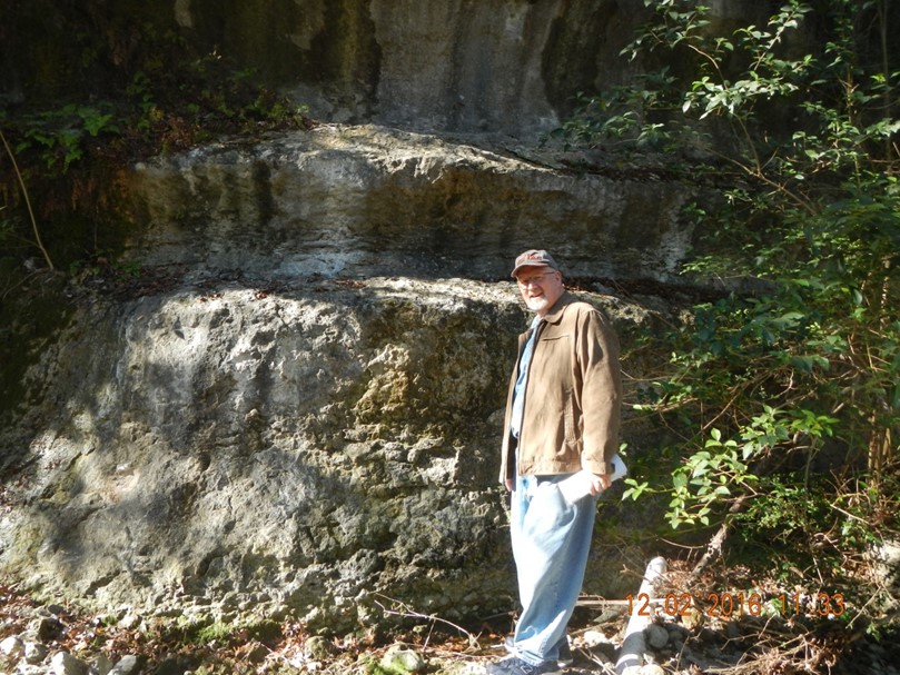
  • Thick Oligocene ash in the upper valley-side bluffs near Rio Grande City

Logistics:   Trip departs from Corpus Christi, TX 9am Saturday (place TBA), and returns to Corpus Christi, TX about 6:30 pm Sunday.  Bus transportation, hotel (double occupancy), guide materials, breakfast burritos, lunches, and water are provided. You cover: dinner, personal items.

Cost:    Estimated at $300, minimum 15 participants.  More details to follow.

Contact:     If you're coming, please contact the trip leaders:

    Thomas Ewing        tewing@fronteraexploration.com

    Juan Gonzalez        juan.l.gonzalez@utrgv.edu

    Dawn Bissell        bissells@swbell.net

View Event →
Feb
6
6:30 PM18:30

Geology and Highway Engineering Problems in Texas

MONITORING AND REPAIR OF DISTRESSED MECHANICALLY STABILIZED EARTH WALL (MSEW): A CASE STUDY OF IH-10 MSEW IN TEXAS

CLICK HERE FOR POWER POINT

Speaker:  Marcus Galvan, PE. Corsair Consulting LLC

Forensic study and the repair measures of a distressed Mechanically Stabilized Earth wall (MSEW) on IH-10 in Beaumont, Texas. The MSEW was built in 1993 experienced a significant separation in the roadway shoulder. This separation was initially dowel stitched. About four years after initial retrofit additional pavement cracks appeared in the travelling lanes. Field inspection, extensive field and laboratory testing and MSEW monitoring using an inclinometer were performed to investigate the cause of the MSEW distress. MSEW stability, based on the laboratory test results, indicates that the MSEW is on the verge of sliding failure. This analysis was verified by the field monitoring conducted using an inclinometer. After several heavy rain events the MSEW showed the sliding behavior that caused great concern for the MSEW stability and the safety of traveling public. Consequently, repair measures were taken using the prestressed ground anchors and soldier piling system.

Bio:   Mr. Galvan has more than 29 years of experience covering broad range of structural, material, geotechnical engineering and construction issues.  For 16 of his 27 years in industry, Mr. Galvan worked in the TxDOT Bridge Division Geotechnical Branch.  Here he supervised and managed personnel engaged in statewide geotechnical activities.  These included the design of bridge foundations, retaining walls, bank and stream scour countermeasures, evaluation and remediation of slope stability issues, forensic evaluations, participation in Value Engineering studies, development of Statewide Bridge Geotechnical Standards and Specifications, planning and execution of geotechnical investigations and construction support for geotechnical structures on Texas Highway Projects.
 

View Event →
Jan
9
6:30 PM18:30

Austin Geological Society Business Meeting

January AGS BUSINESS MEETING: The AGS Executive Committee is required to report at lest once a year to the Membership.  We are holding a business meeting in the BEG Conference Room 6:30-8:00 pm on Monday, January 9th (the SECOND Monday in January).  A lot has been achieved in the past year - more than can be communicated before the regular meeting.  The ExCom will bring the membership up to date on what has been done, and BRIEF committee reports will be read.  We encourage members present to ask questions and make suggestions.


This is a business meeting so there will be no technical presentation or pizza. 

John Berry,
AGS President

Location:

BEG Conference Room
UT Austin, JJ Pickle Research Center
101 Burnet Rd., Bldg 130

View Event →