Geo Photos
Below are some select photographs taken by AGS members that represent many aspects of the science and profession.
Photos found throughout the website can be used for education purposes, but please cite source and photographer.
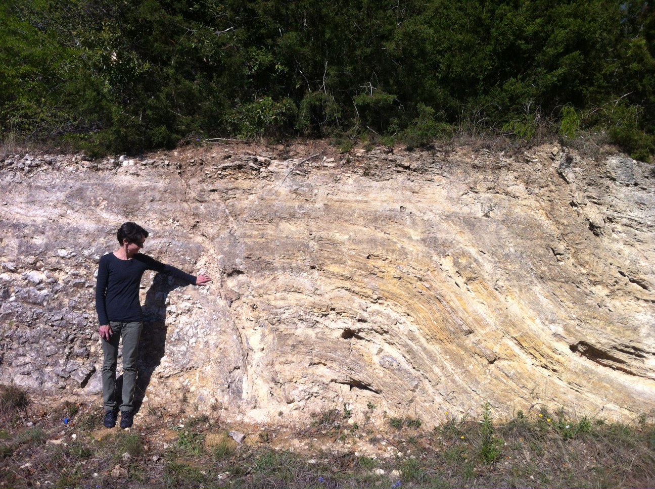
Central Texas Geology
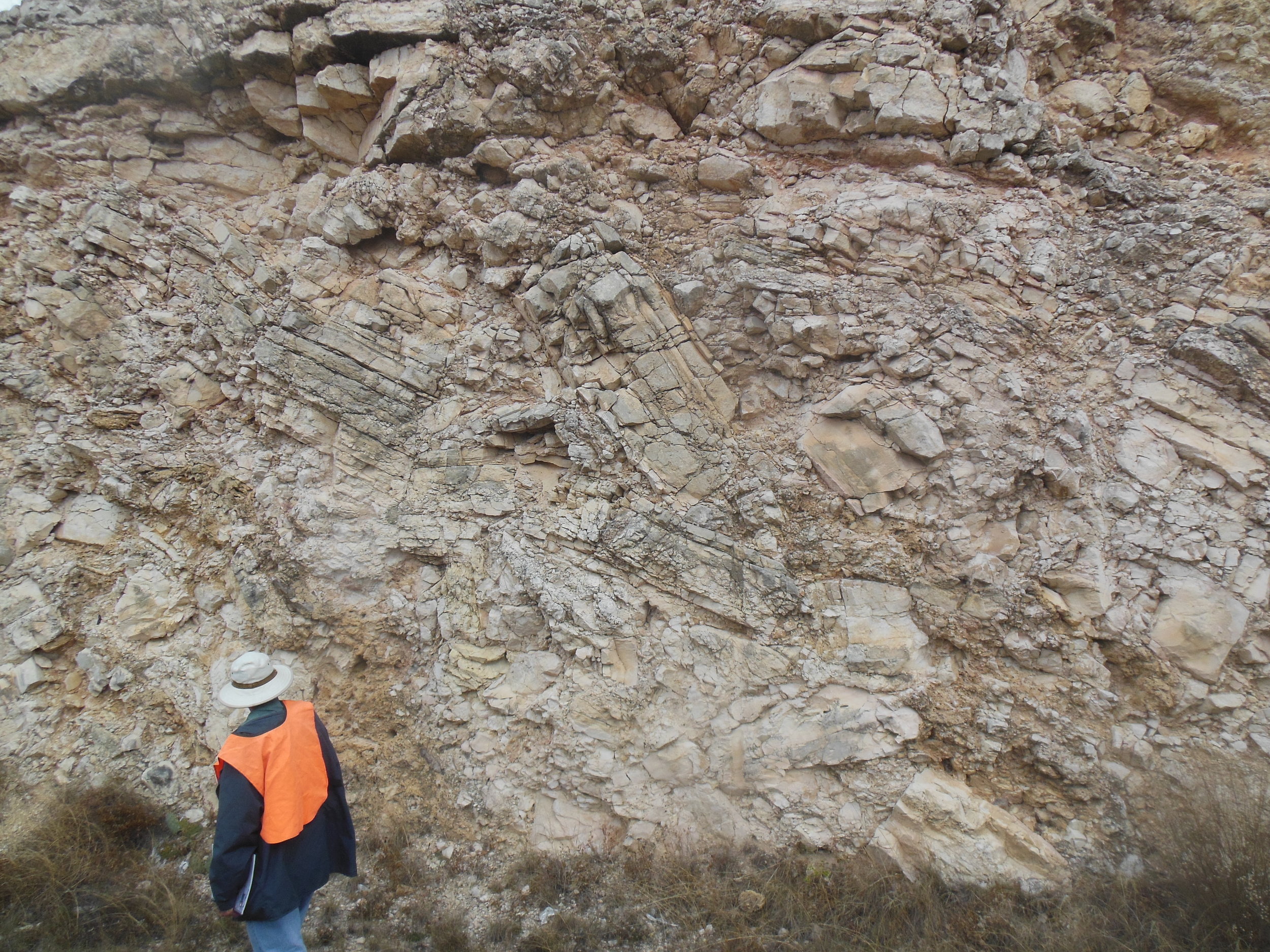
Evaporite-related Collapse feature
Edwards Group limestones along IH-10 near Junction. Photo by John Berry.
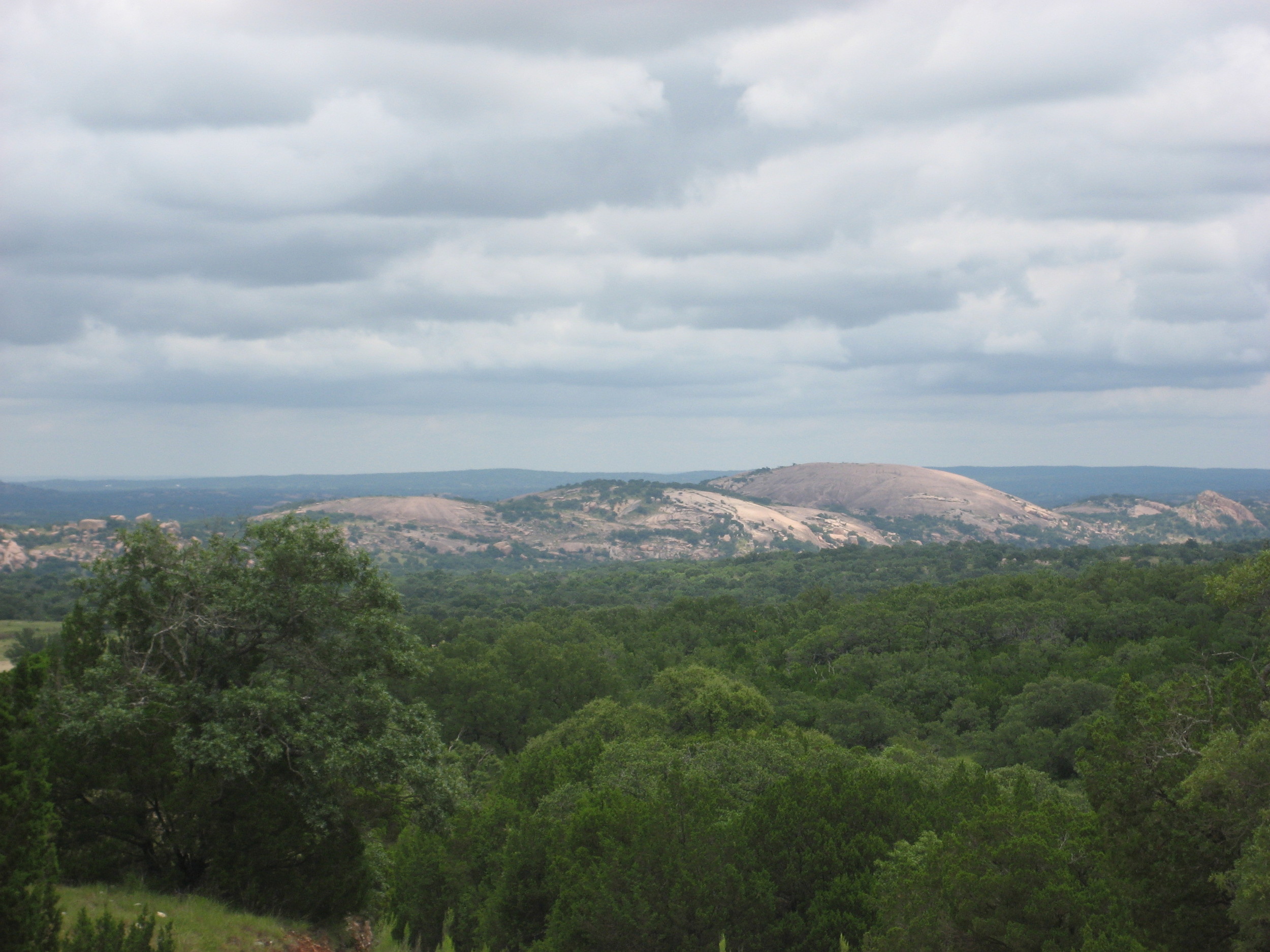
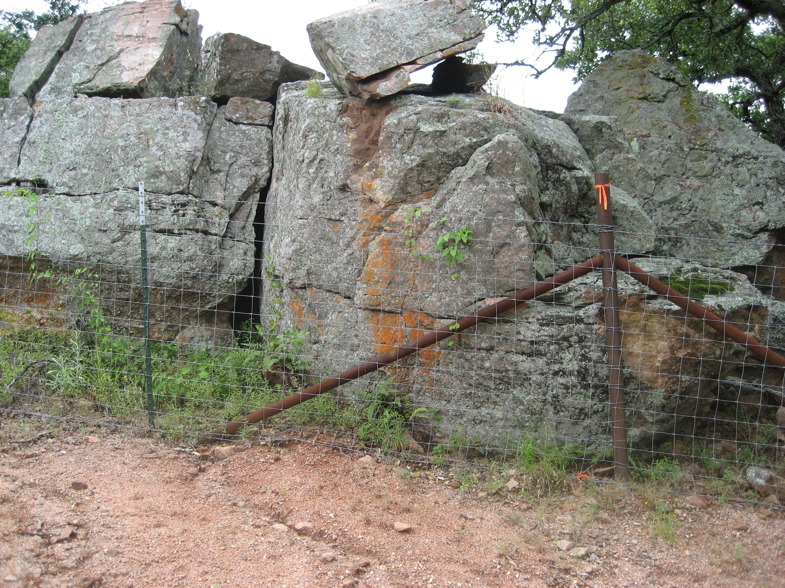
Enchanted Rock
Precambrian granite batholith. Photo by Brian Hunt.
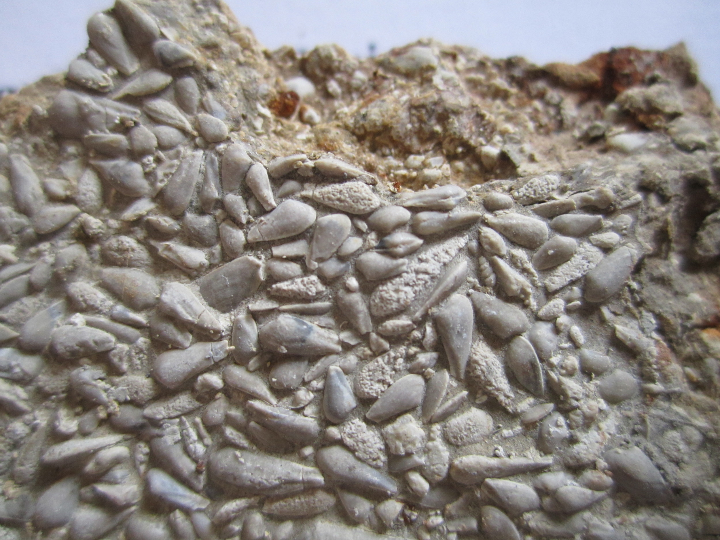
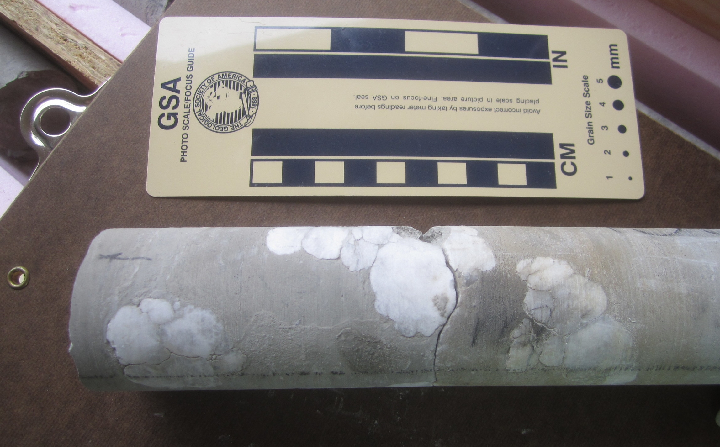
Corbula
Fossil "corbula" from the Glen Rose Fm. Scale is about 2 inches across.
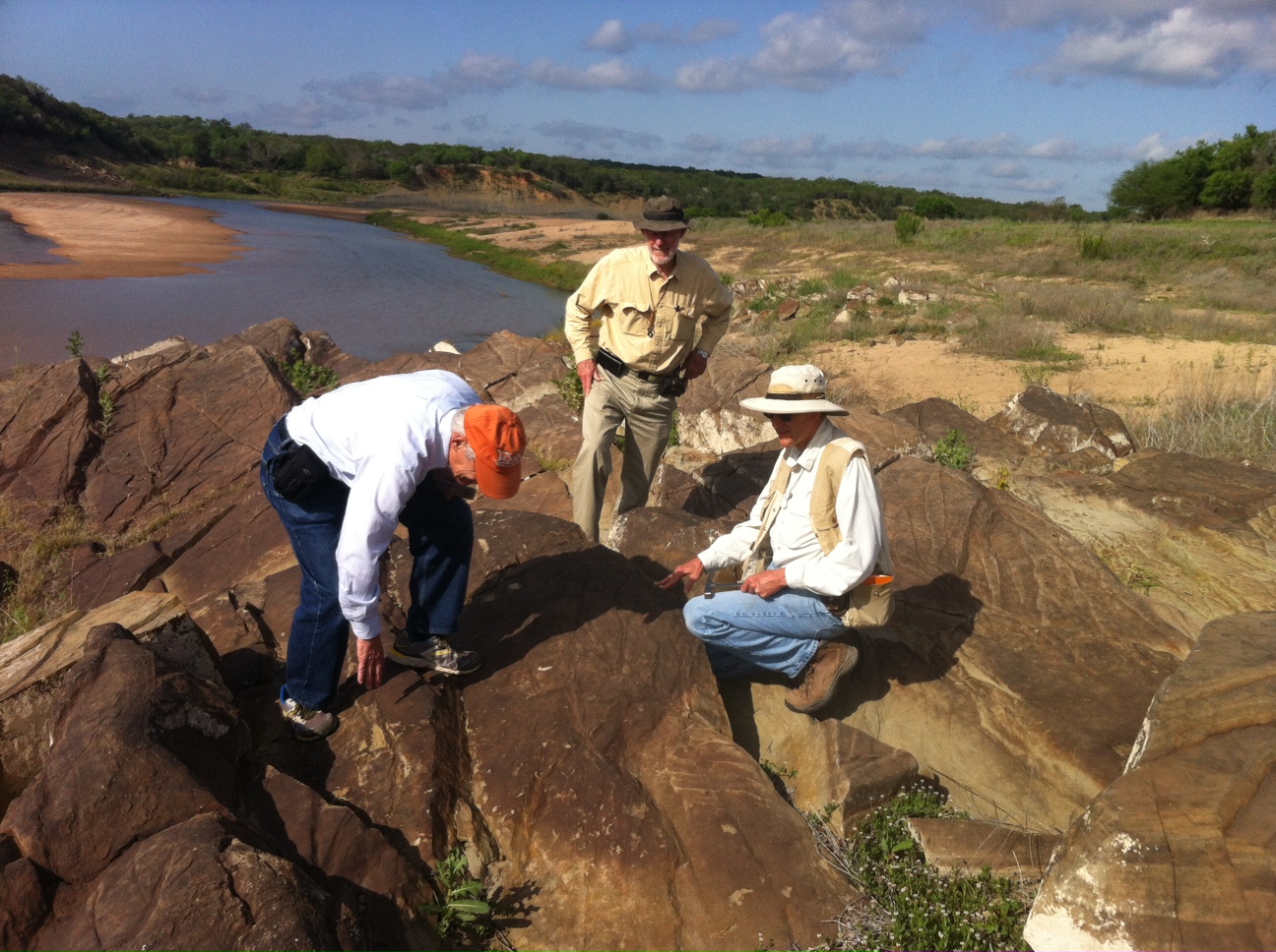
Field geologists
Discussing structures in the Paleozoic Smithwick Fm. along the Colorado River.
Balcones Fault
Fault along the Blanco River. Left side is the Upper Glen Rose, right side is the Edwards. Photo by Brian Hunt.
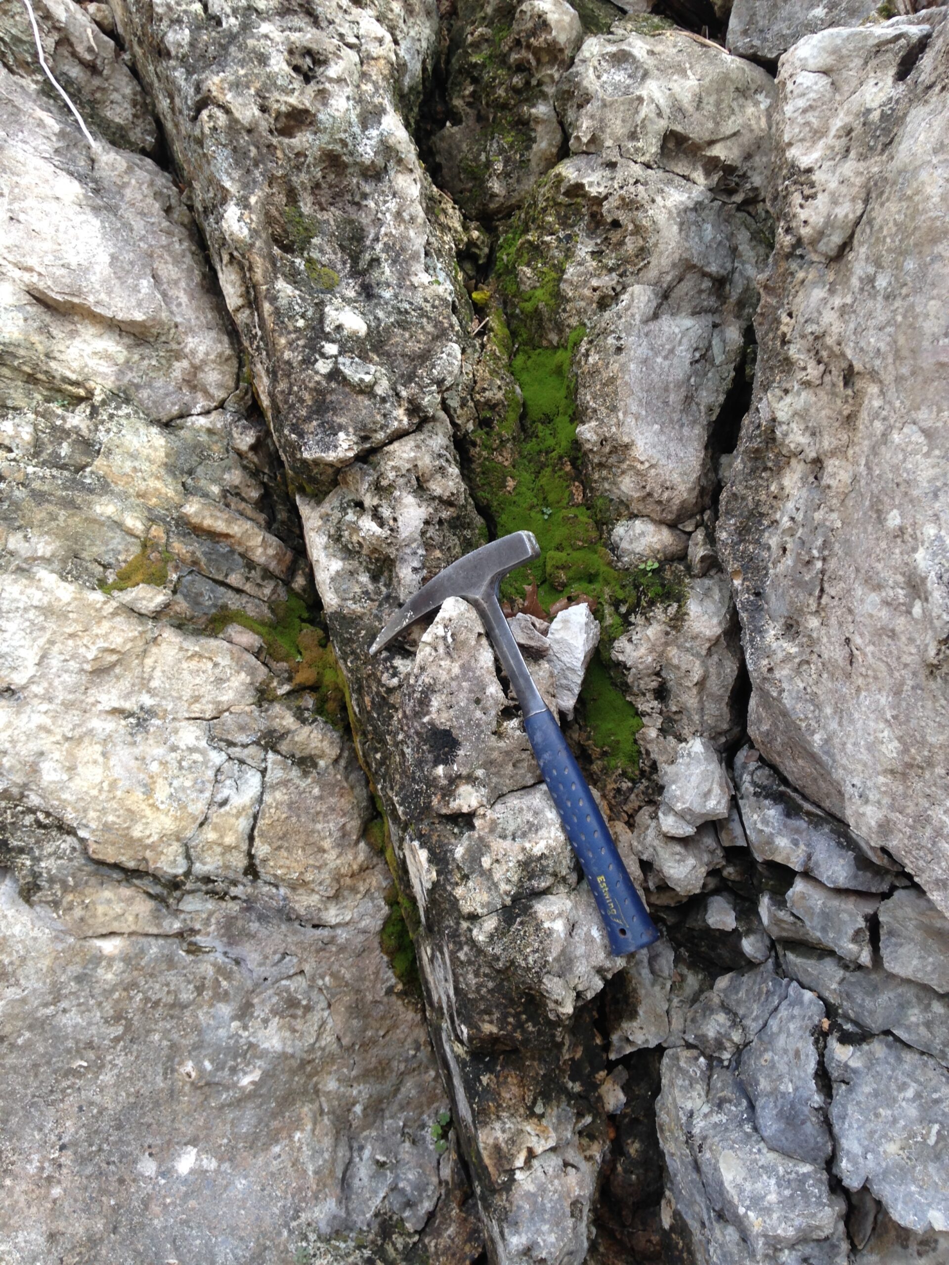
Cambrian ripples
Ripple structures in the Hickory Sandstone. PHoto by Brian Hunt.
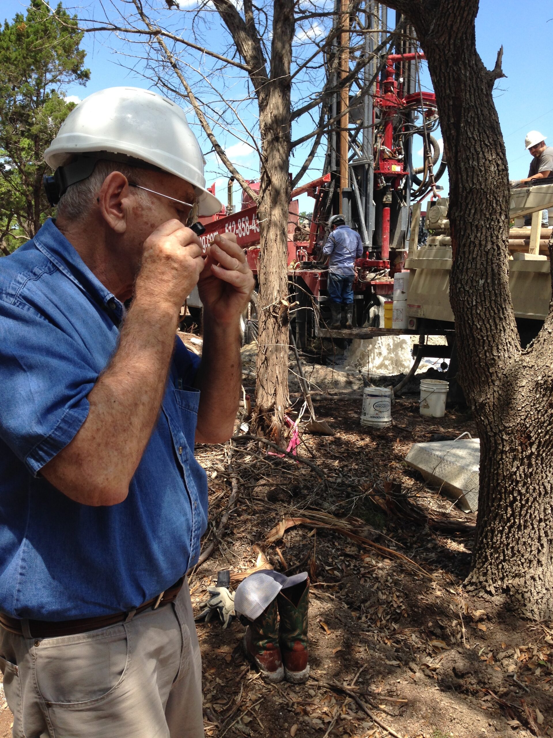
Geologist at well site
Al Broun examining cuttings from a well near Wimberley.
GEO Photography
Barton Springs Fault
The left side is the Georgetown Fm. and the right side is the Edwards Group. Photo by Brian Hunt.
Garden Ridge Fault
Fault between the Del Rio clay and the Georgetown Fm. Photo by Brian Hunt.
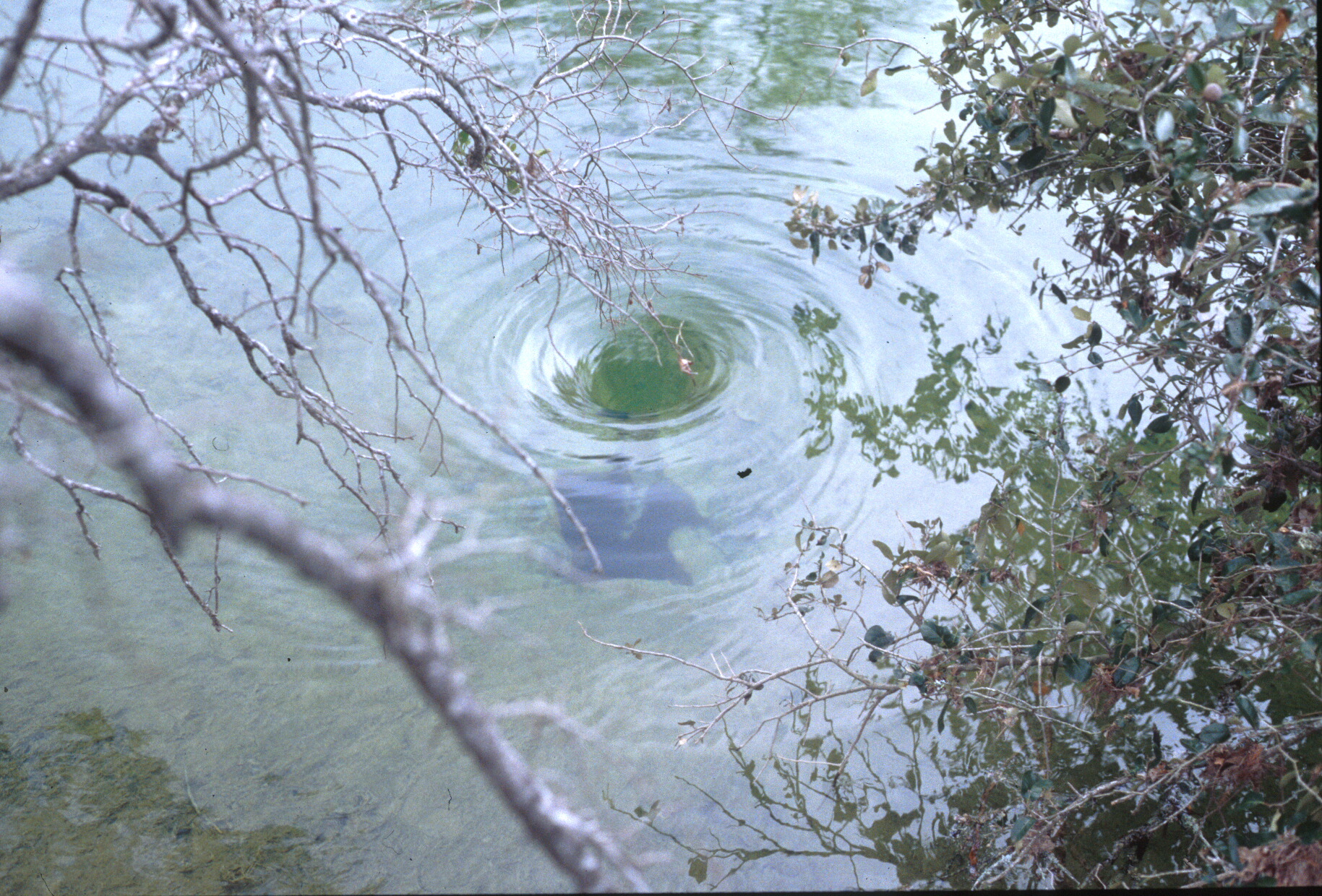
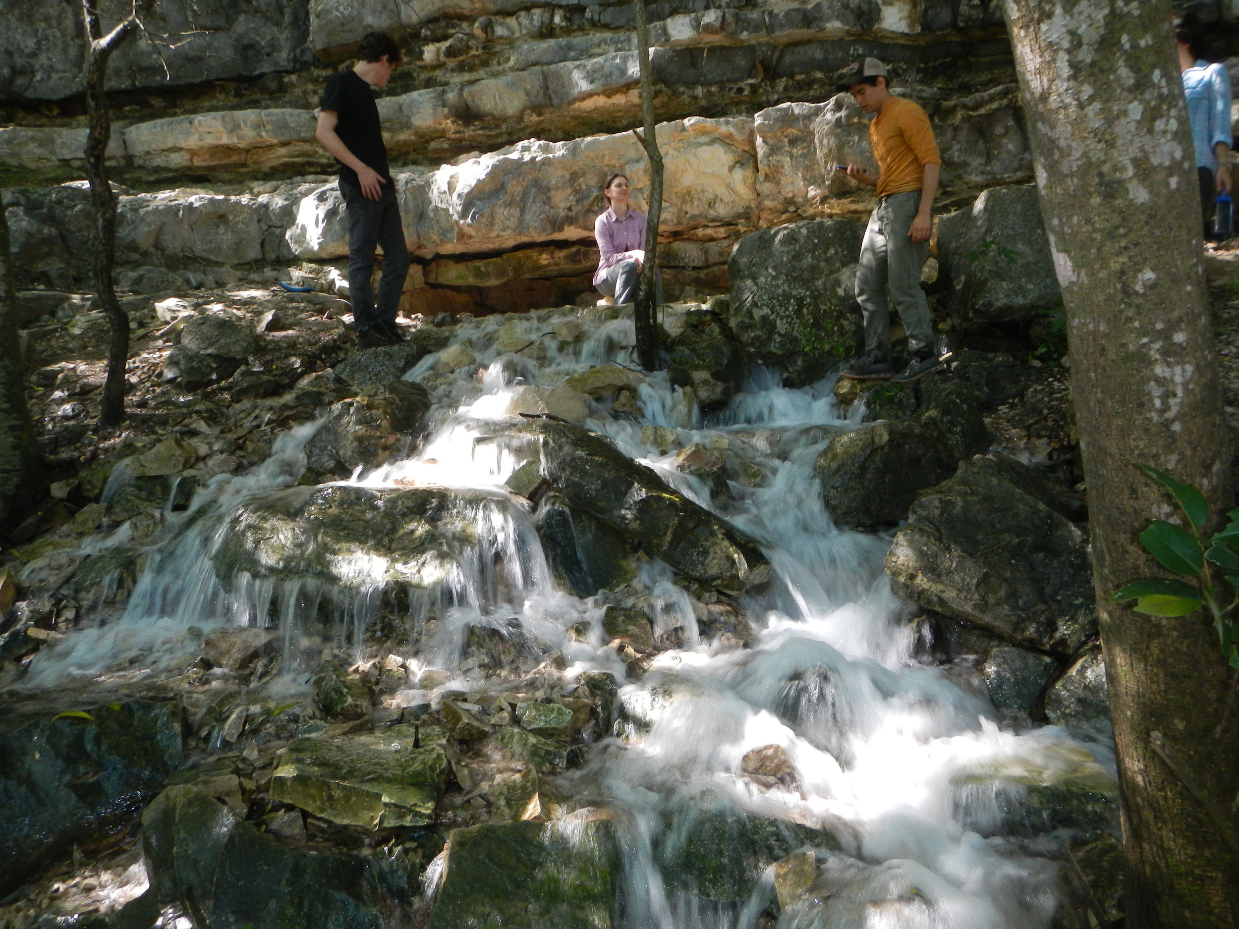
Whirlpool over Crippled Crawfish Cave
Recharge feature in Onion Creek on CoA protection lands. Photo by CoA.
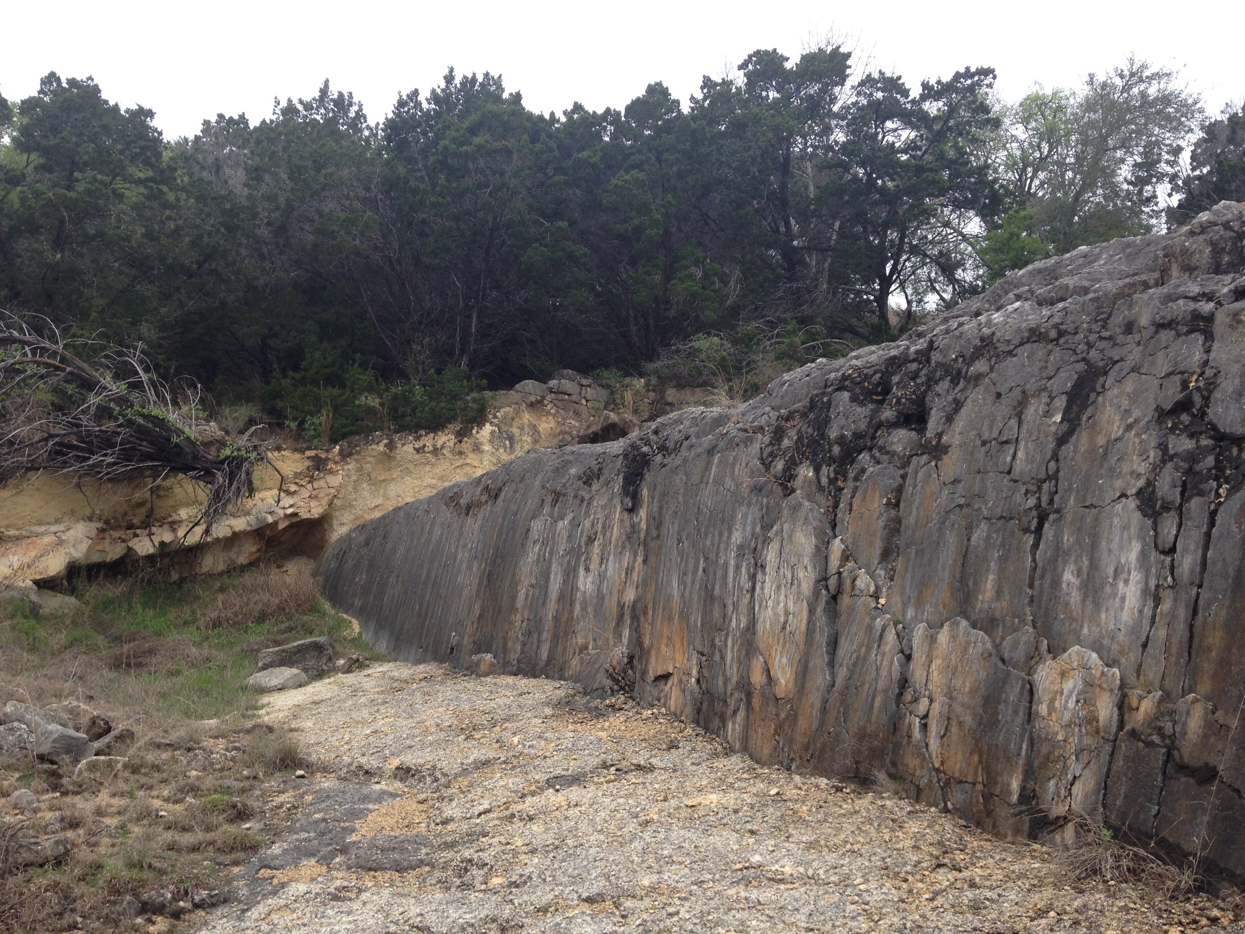
Reimer's Ranch Climbing Wall
Cow Creek Formation. Photo by Brian Hunt.
Sycamore Fm.
Lower Cretaceous conglomerate and sandstones along the Pedernales River. Photo Brian Hunt.
Nonconformity
Precambrian granite overlain by the Cambrian Hickory Sandstone in Llano County.
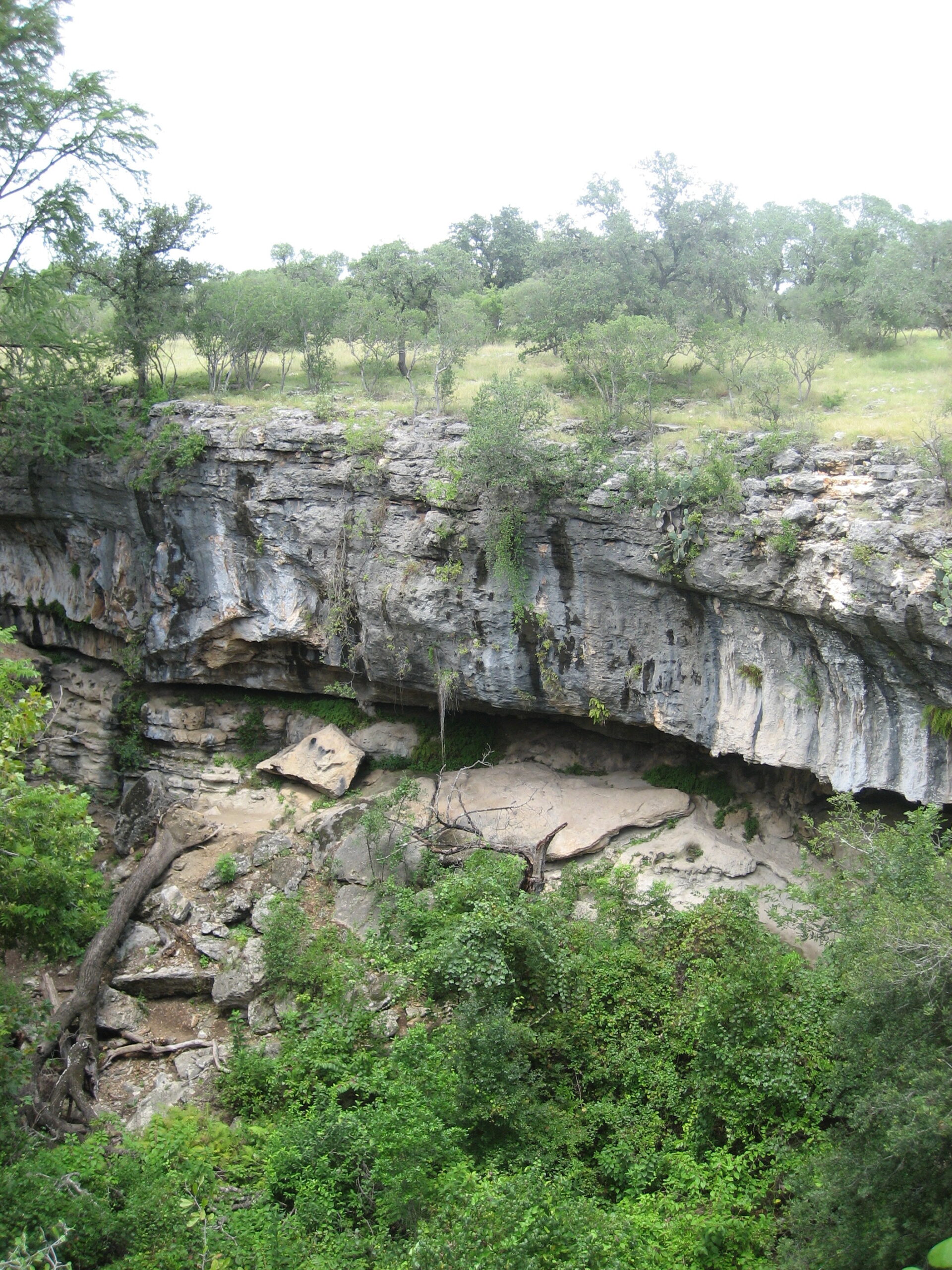
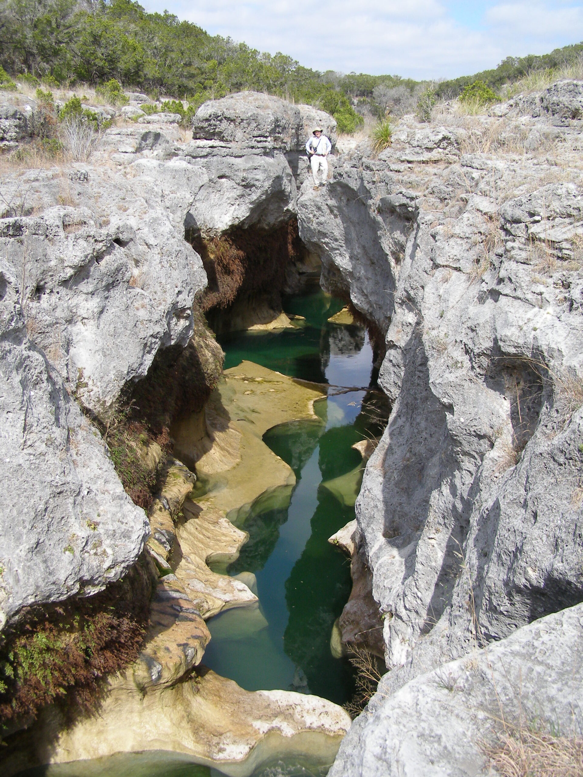
Narrows
Canyon carved in the Lower Glen Rose Fm., Hays County. Photo by Brian A. Smith.
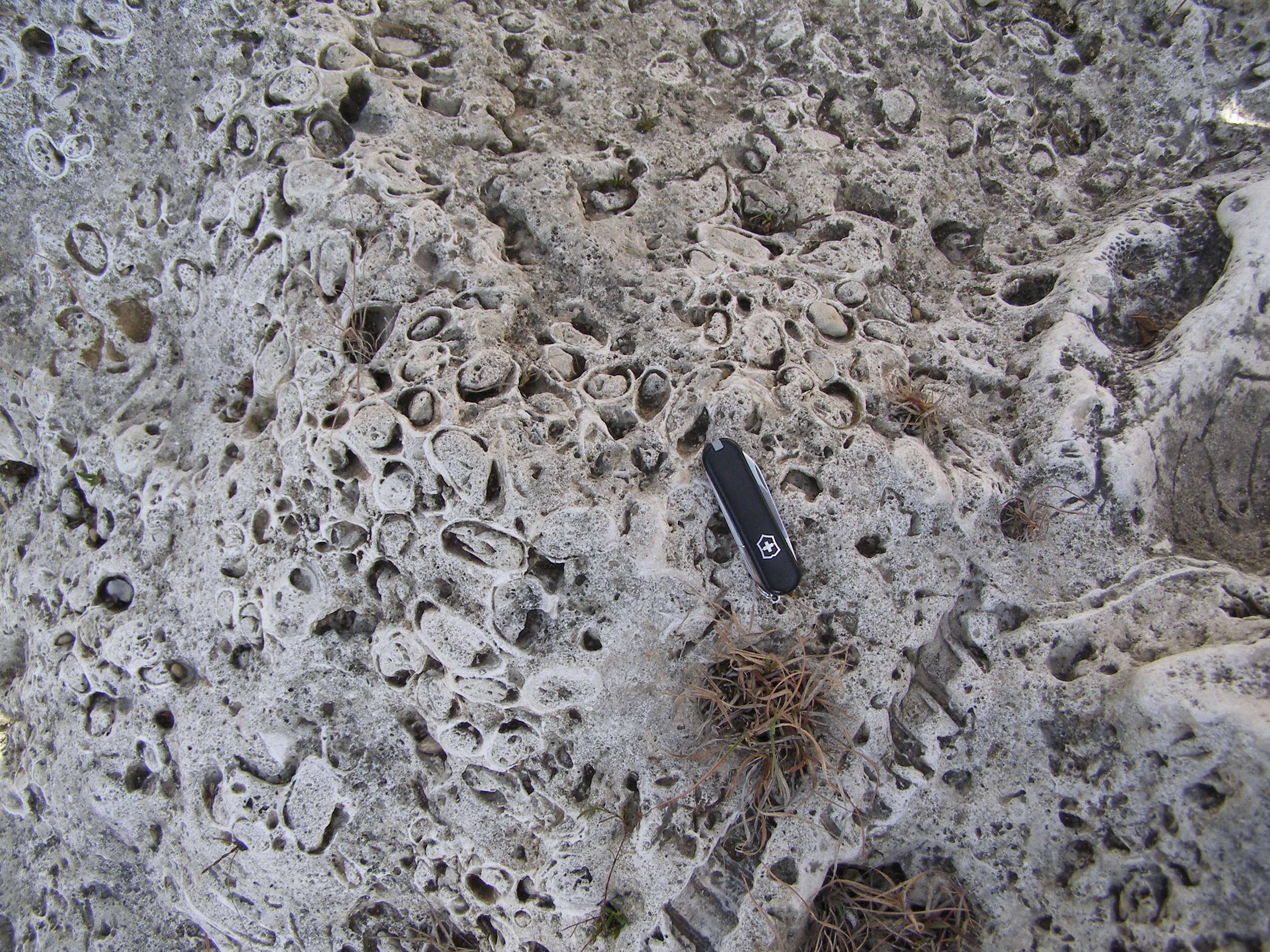
Cretaceous reef
Close up of the coral-rudistid boundstone of the Narrows. Photo by Brian A. Smith.
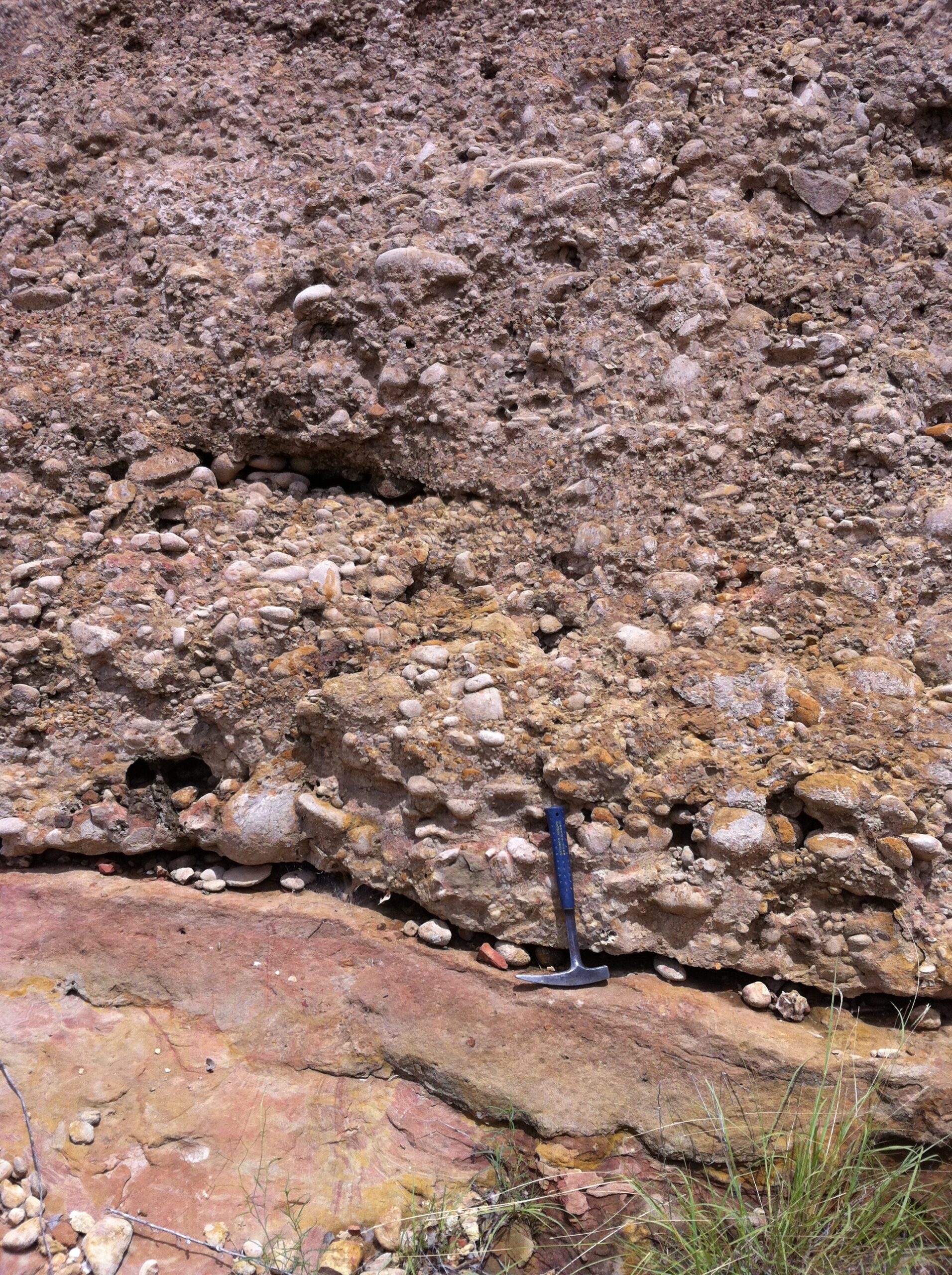
Evaporite Nodules
Upper Glen Rose Fm., Travis County.
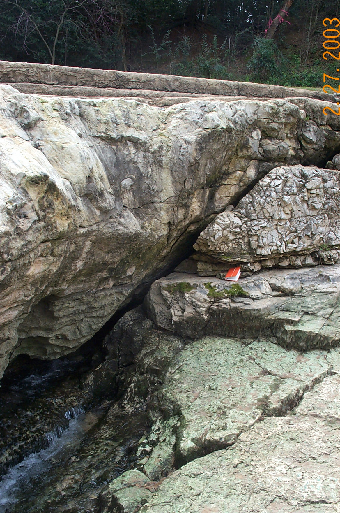
Fault Scarp
Canon Gorge, Upper Glen Rose. Photo Brian Hunt
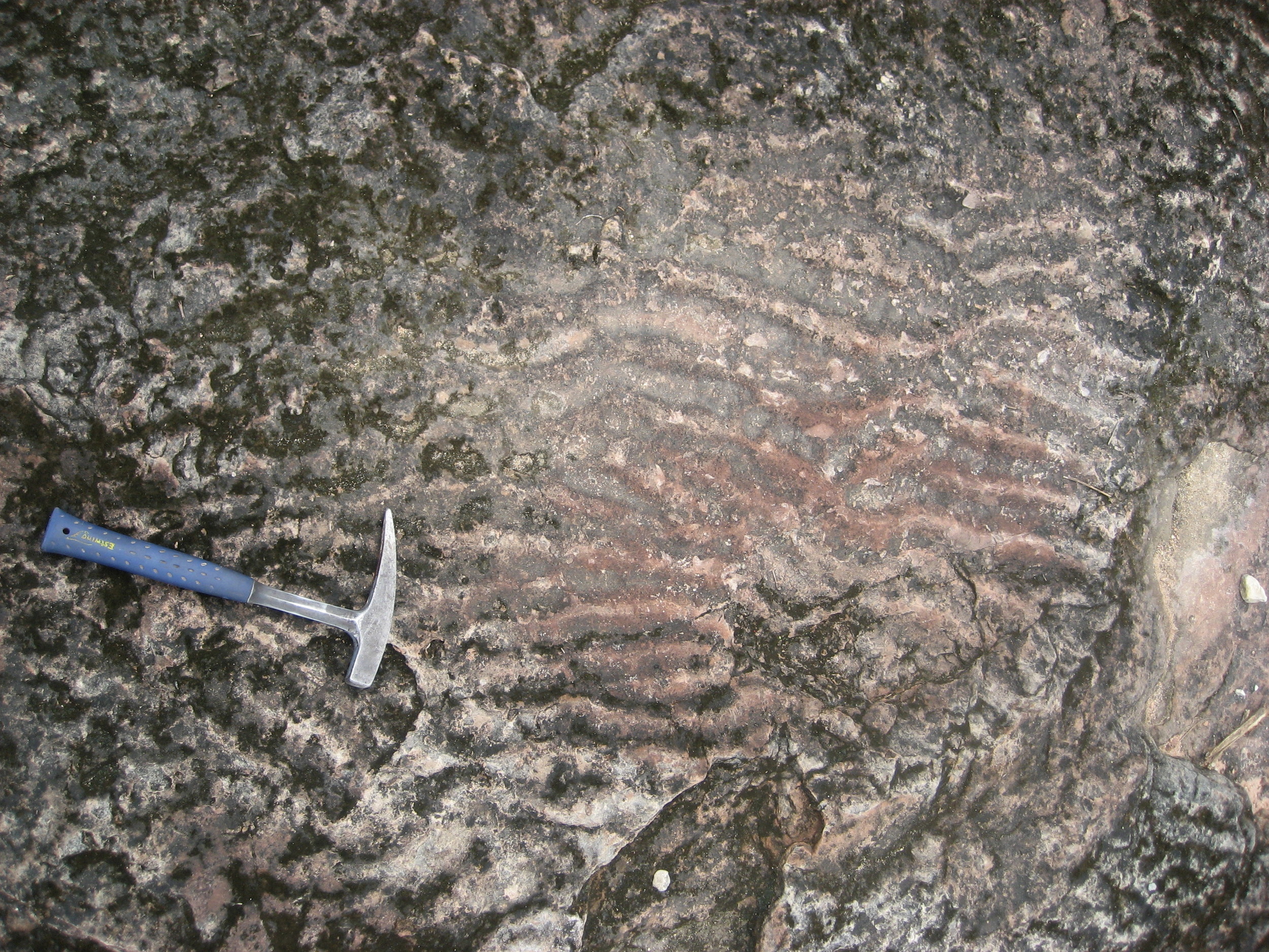
Salenia texana fossils
Canyon gorge. Photo Brian Hunt.
Hydrogeology in central Texas
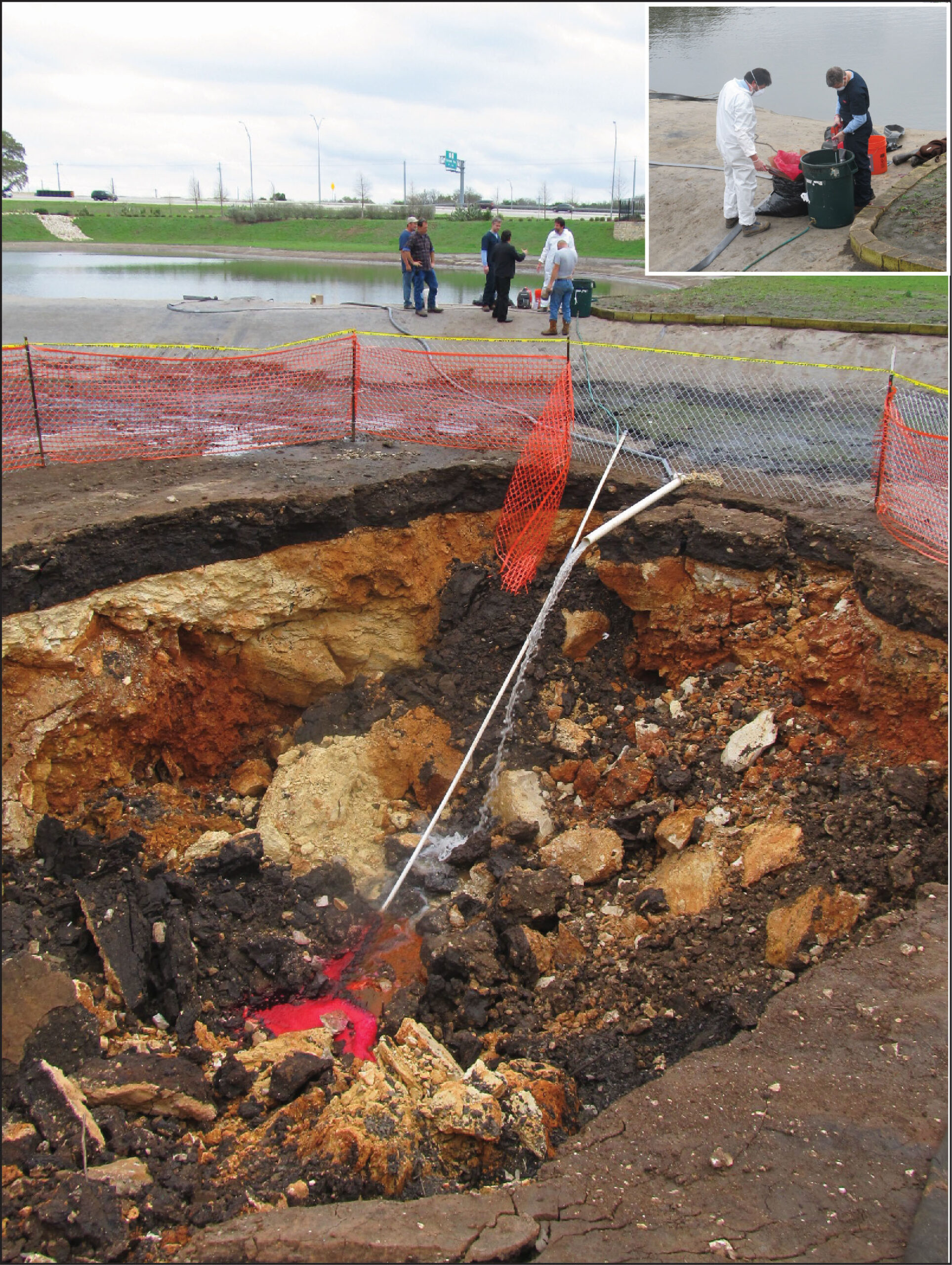
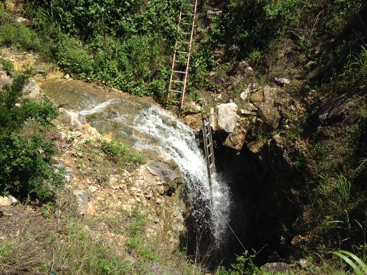
Dye tracing a sinkhole
Sinkhole developed in a storm water pond in south Austin. Photo by Brian Hunt.
Rainfall defining the Balcones Escarpment
Screen capture of a storm May 2015, photo by Brian Hunt.
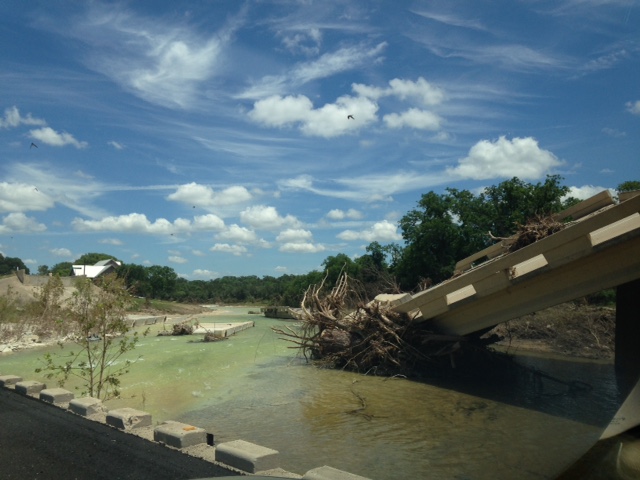
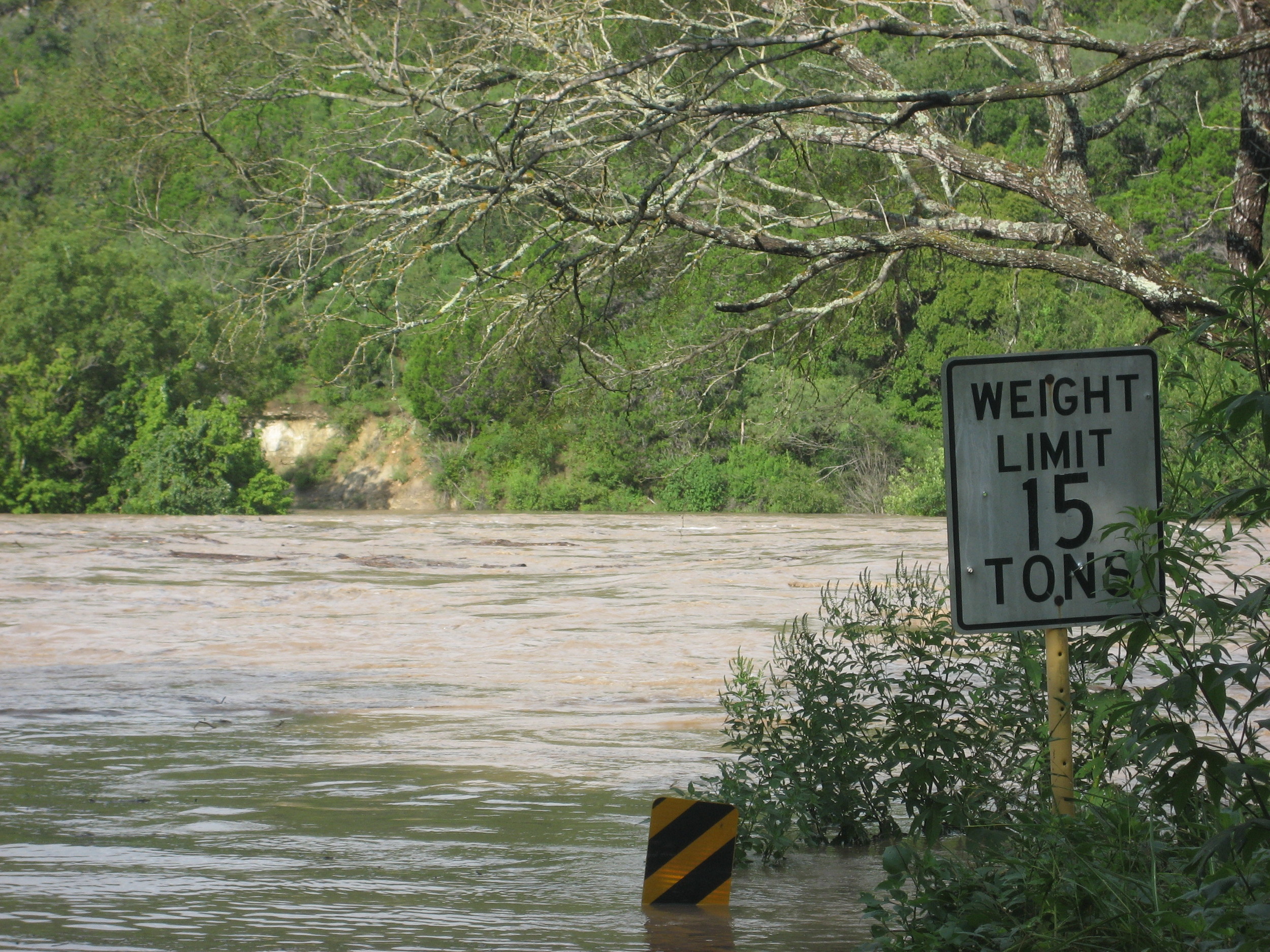
Blanco River Bridge Washout
May 2015 floods were devastating to life and property. Bridge on hwy 165 near Blanco. Photo by Brian Hunt.
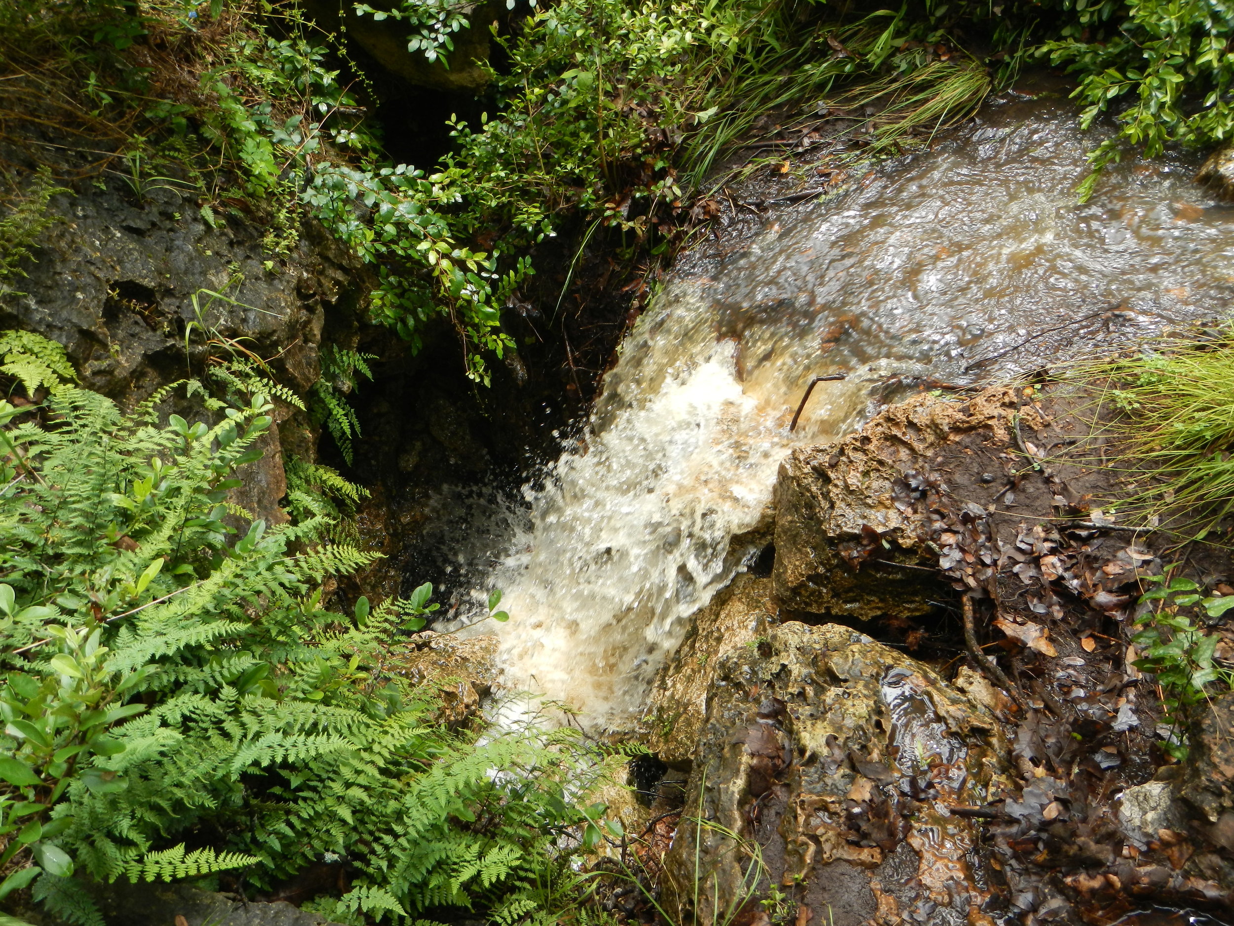
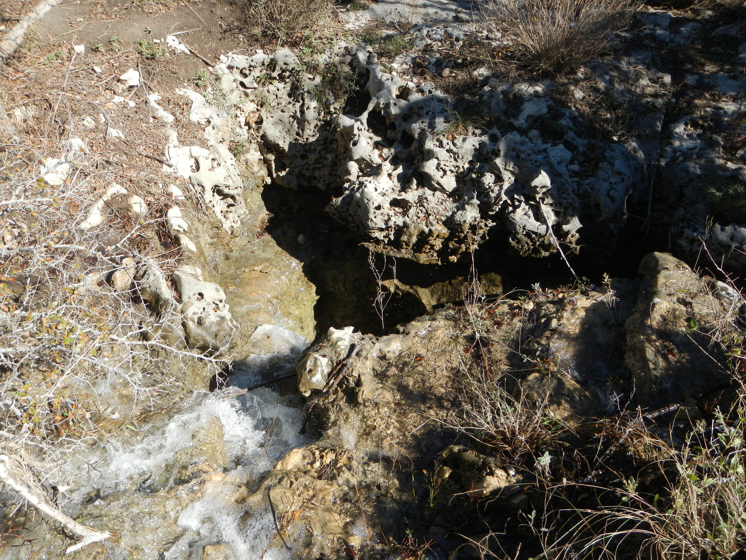
Kiwi Sinkhole
Recharge into Kiwi Sinkhole, near Driftwood Tx. Photo by Brian Hunt.
Flooding Pedernales
Flood at Hammett's Crossing in 2007.
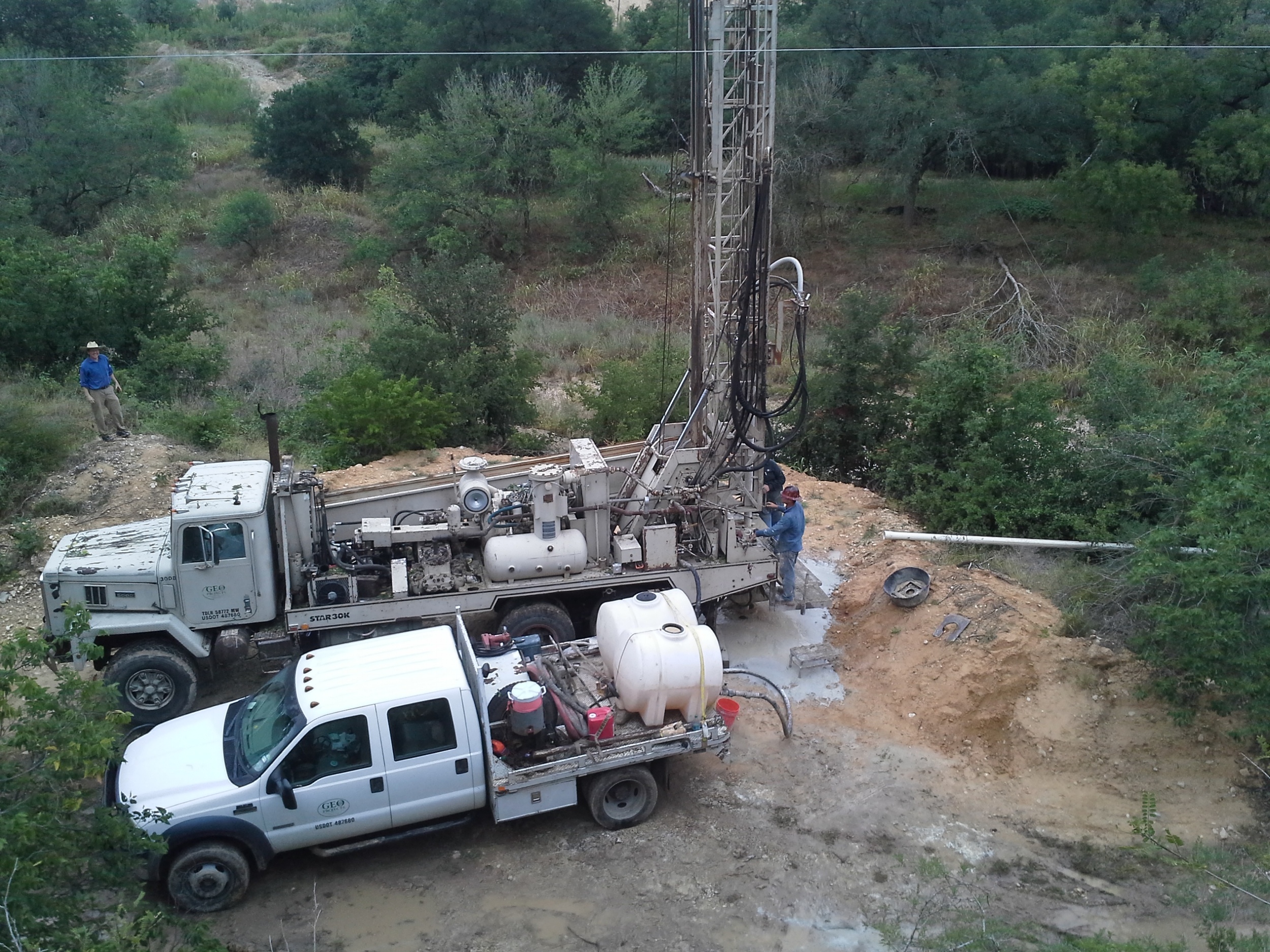
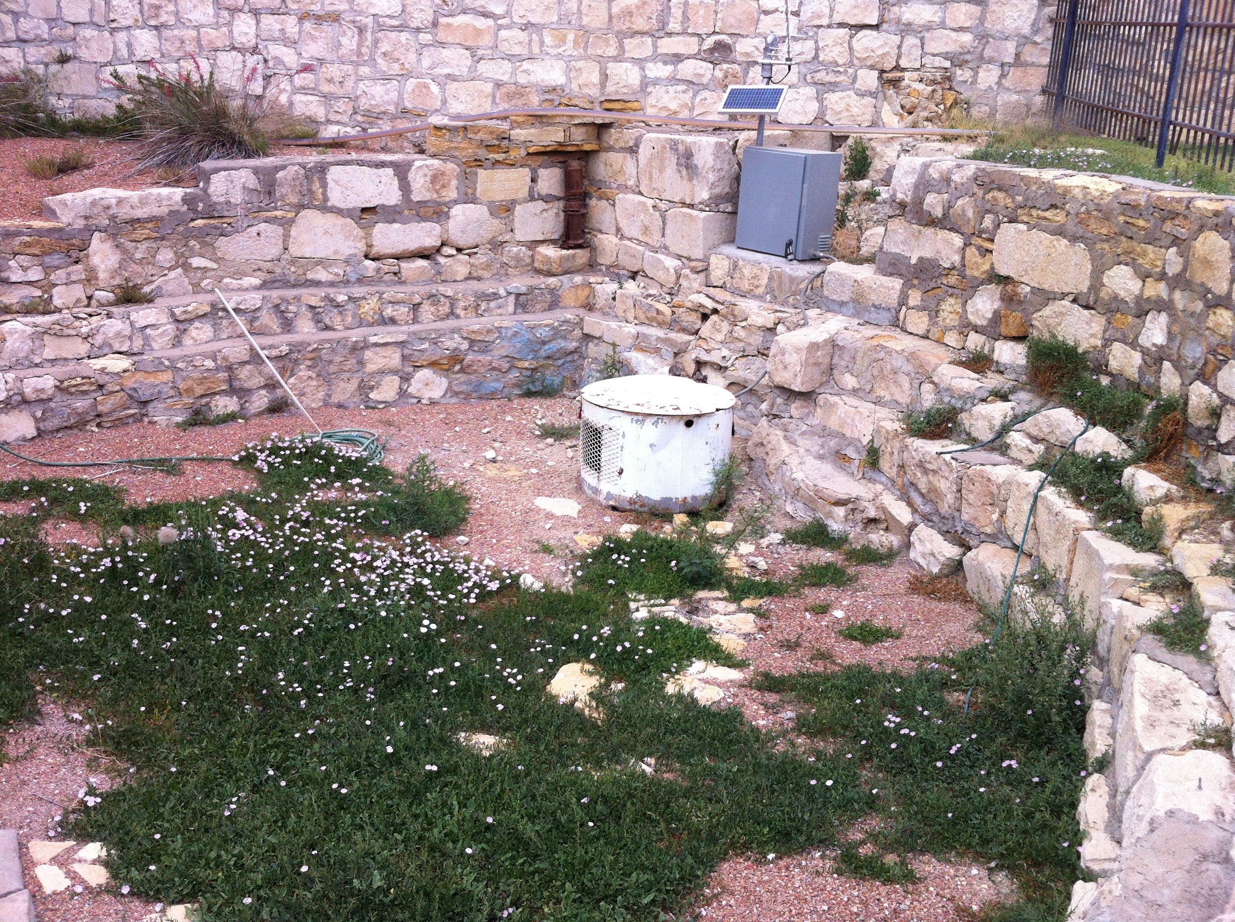
Monitor Well Drilling
Adjacent to Antioch Cave on Onion Creek, Hays County.
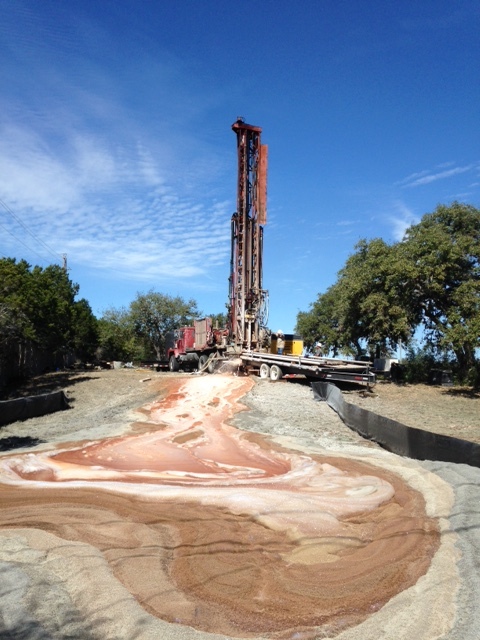
Multiport Monitor Well
Producing water during drilling in the Edwards Aquifer near Buda, Hays County. Photo by Brian Hunt.
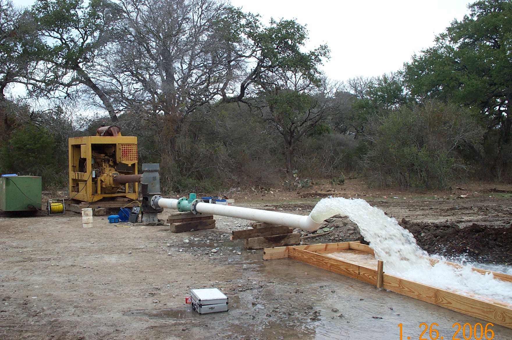
Aquifer Test
Pumping for aquifer test in the Edwards Aquifer near Buda, Hays County.
Domino Spring, Barton Creek
Located on the bank of Barton Creek downstream of Loop 360 close to Airman’s Cave. It discharges from the base of a “cliff” in an area of several other similar springs. These springs only discharge what water levels in the BSEA are exceptional high such as the summer of 2016. They last flowed in the spring of 1992 following exceptional winter rains. Photo David Johns.
Flint Ridge Cave
Recharge into Flint Ridge Cave following heavy rain May 2016. Photo David Johns.
Swallet
Located on Little Bear Creek near RR967. Photo David Johns.
Monitor Well Drilling
Travis County Multiport Well. Photo by Brian Hunt, 2017.
Geology Farther Afield
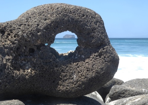
Galapagos
Tuff cone of Daphne Major Island viewed through basalt of North Seymour Island (~4 Ma), central Galapagos. Photo by Patricia Dickerson.
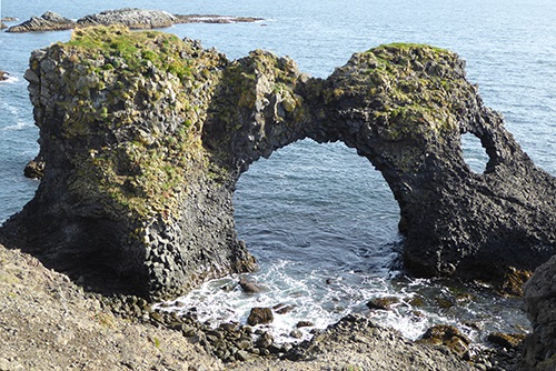
Iceland
Arnarstapi, sea stacks of columnar basalt carved from a post-glacial (3,900 Ka) a'a flow, Snaefellsnes Peninsula, Iceland. Photo by Patricia Dickerson.
Victoria Falls, Zimbabwe/Zambia
October 1968: the Zambesi River in flood falling 108m over a width of 1700m, at the rate of 3000m3s-1. Photo John Berry.
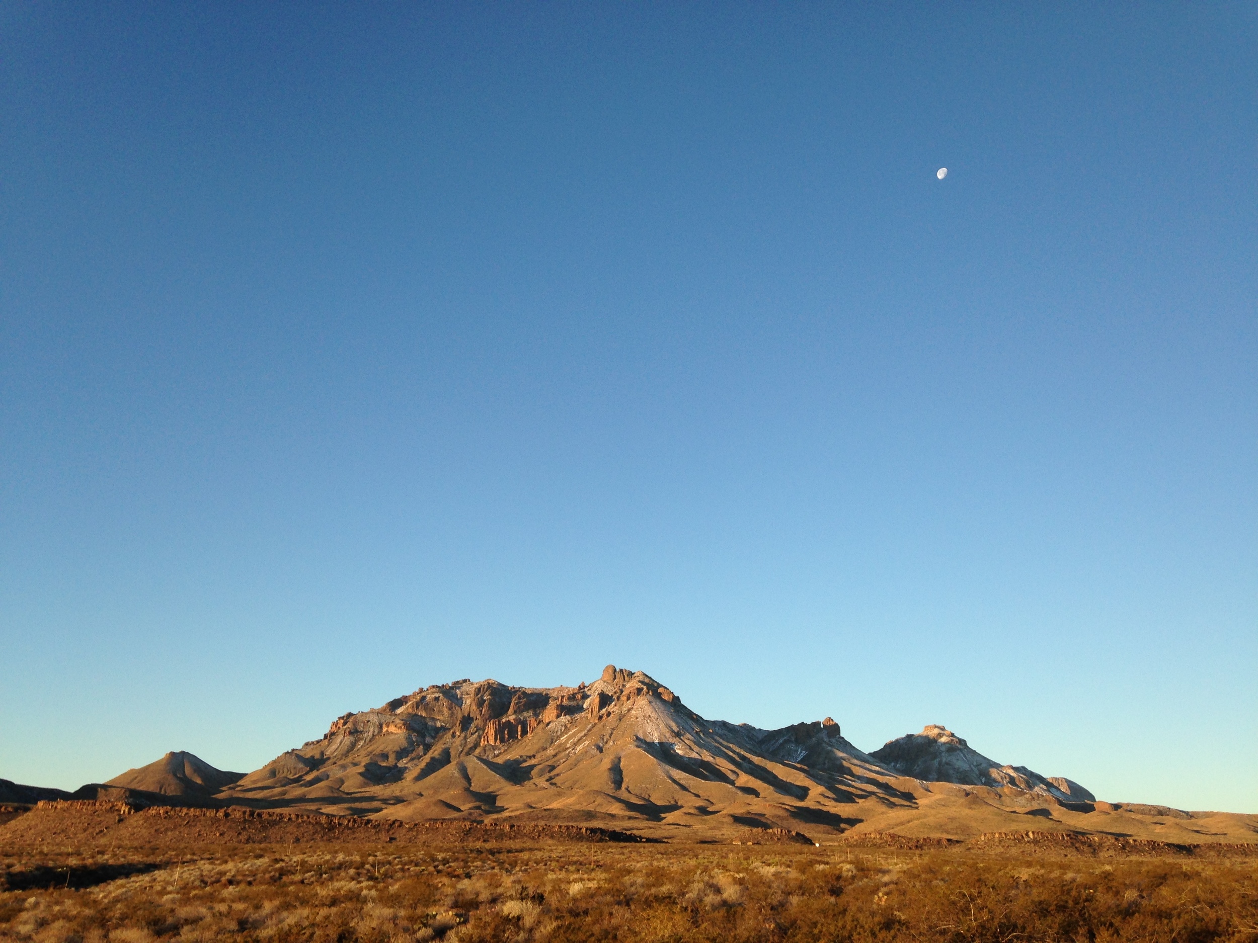
Chisos Mountains, West Texas
View of the volcanic Chisos Mountains, Big Bend National Park. Photo by Brian Hunt.
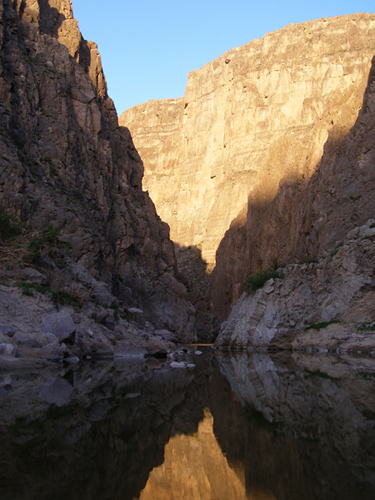
Mariscal Canyon, Big Bend
View to west from Cross Canyon. Massive Lower Cretaceous Santa Elena Ls. and shattered Boquillas Fm (light gray, foreground). Photo by Patricia Dickerson
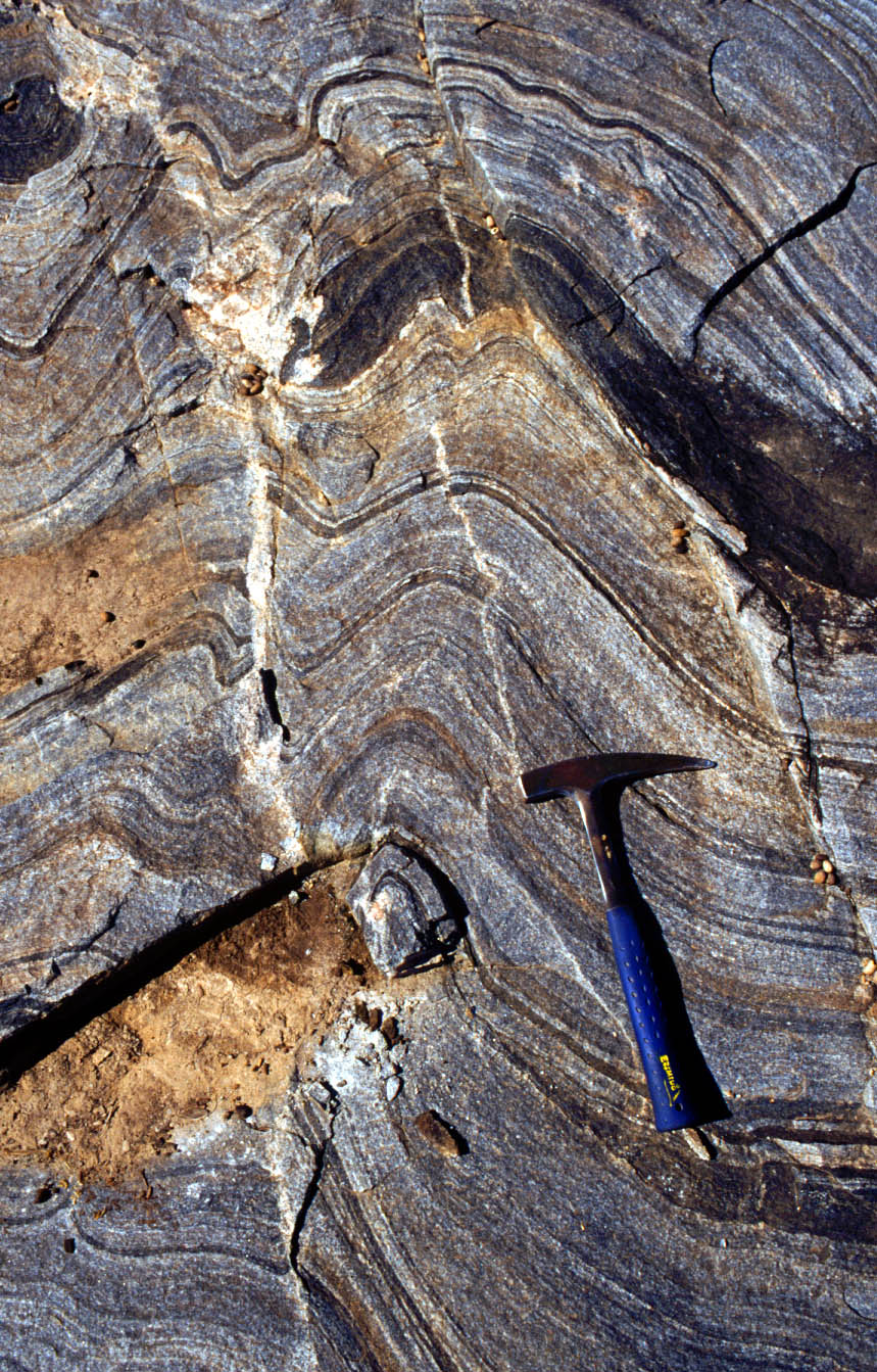
Marathon fold-thrust belt, West Texas
Photo by William R. Muehlberger
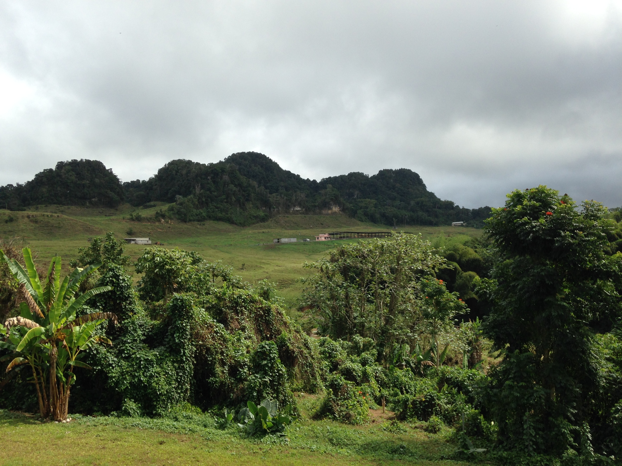
Mogotes
Karst landform of Puerto Rico. Hills are called Mogotes. Photo by Brian Hunt.
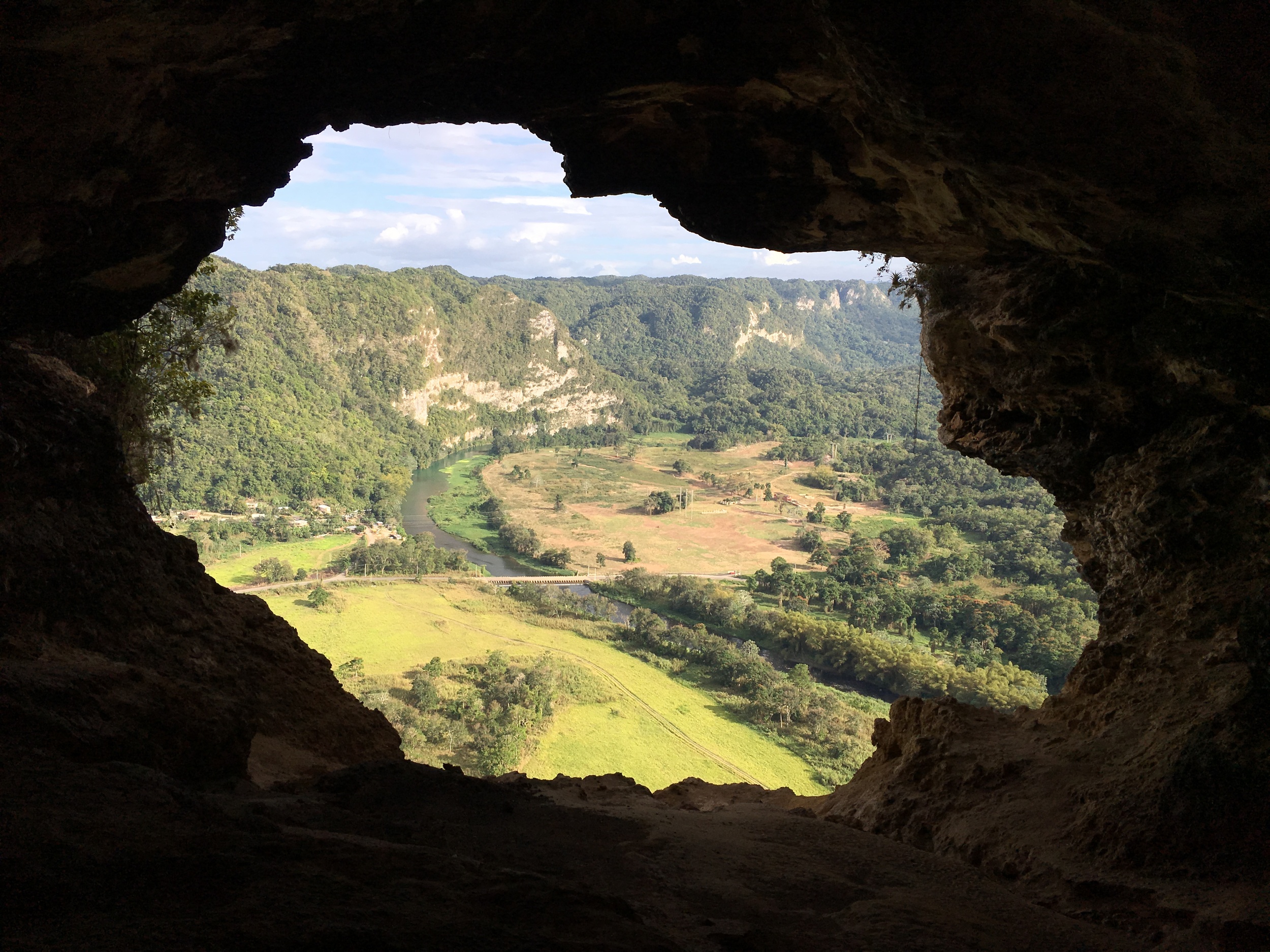
Cueva Ventana
Puerto Rico. Photo Brian A. Smith.
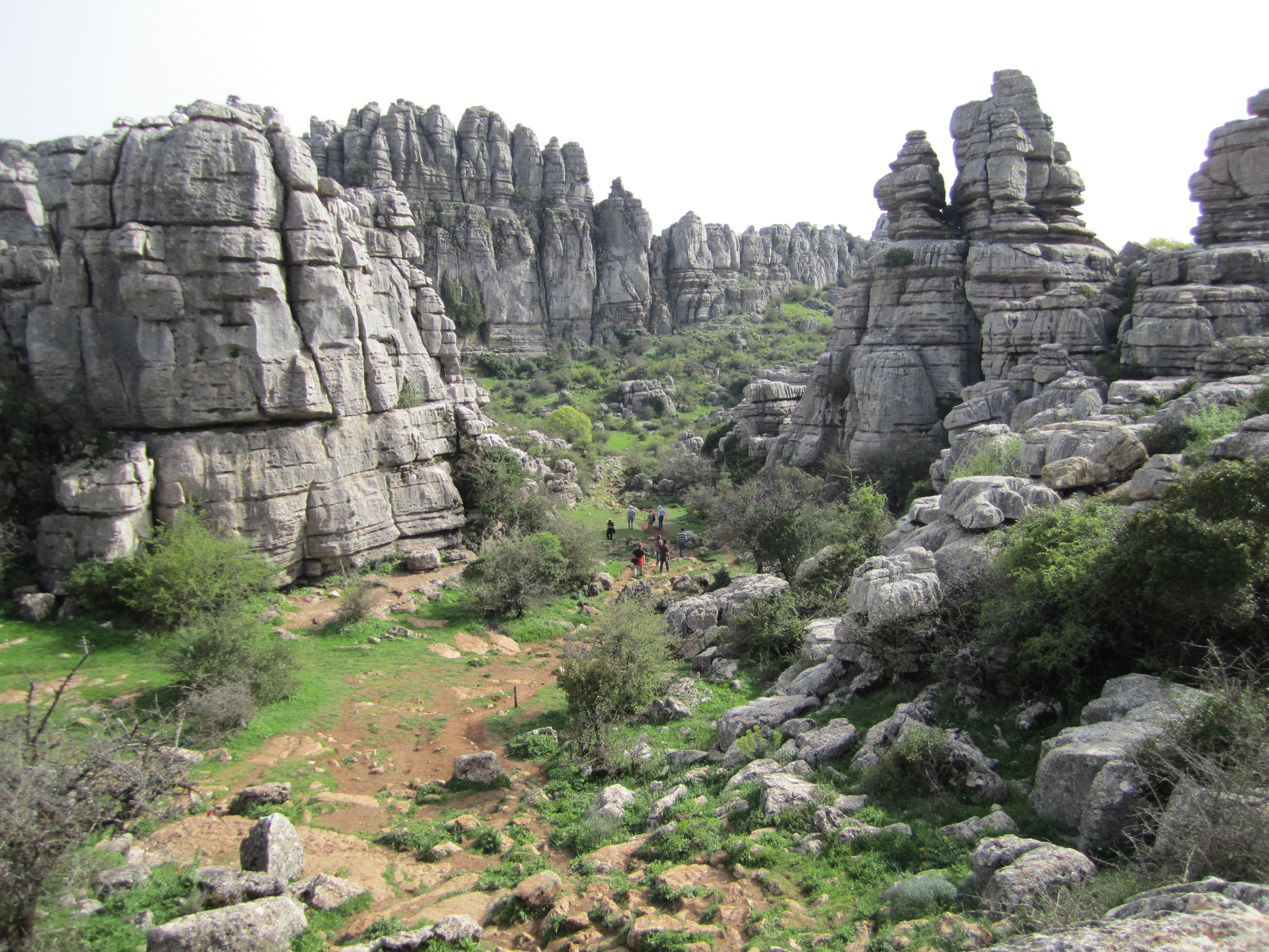
El Torcal
Famous karst landforms in southern Spain. Photo Brian A. Smith.
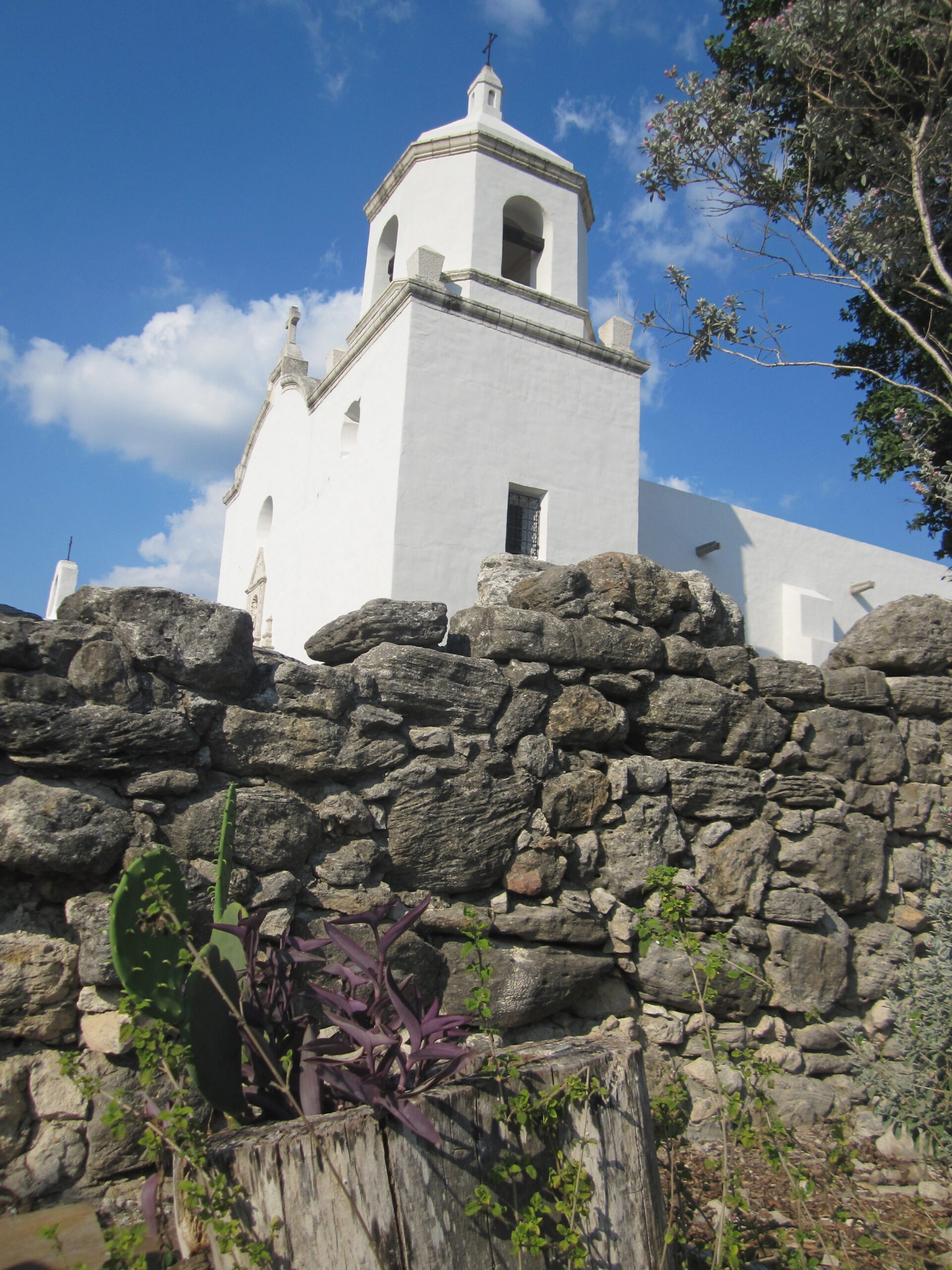
Goliad Sandstone
Cross-bedded standsone of the Goliad Sandstone Fm make up much of the Mission. Photo Brian Hunt.
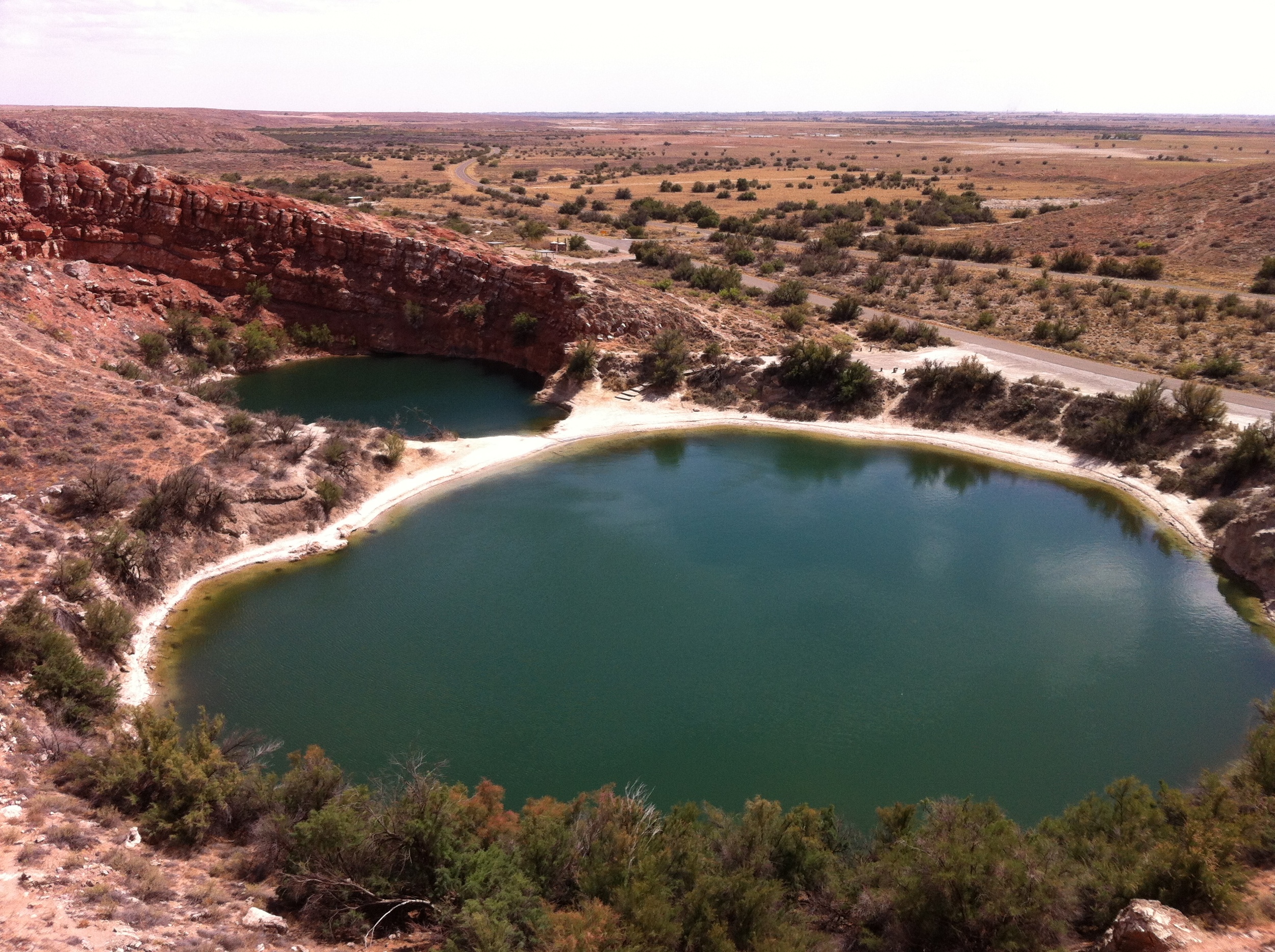
Sinkholes
Bottomless Lakes State Park, New Mexico. Photo by Brian Hunt.
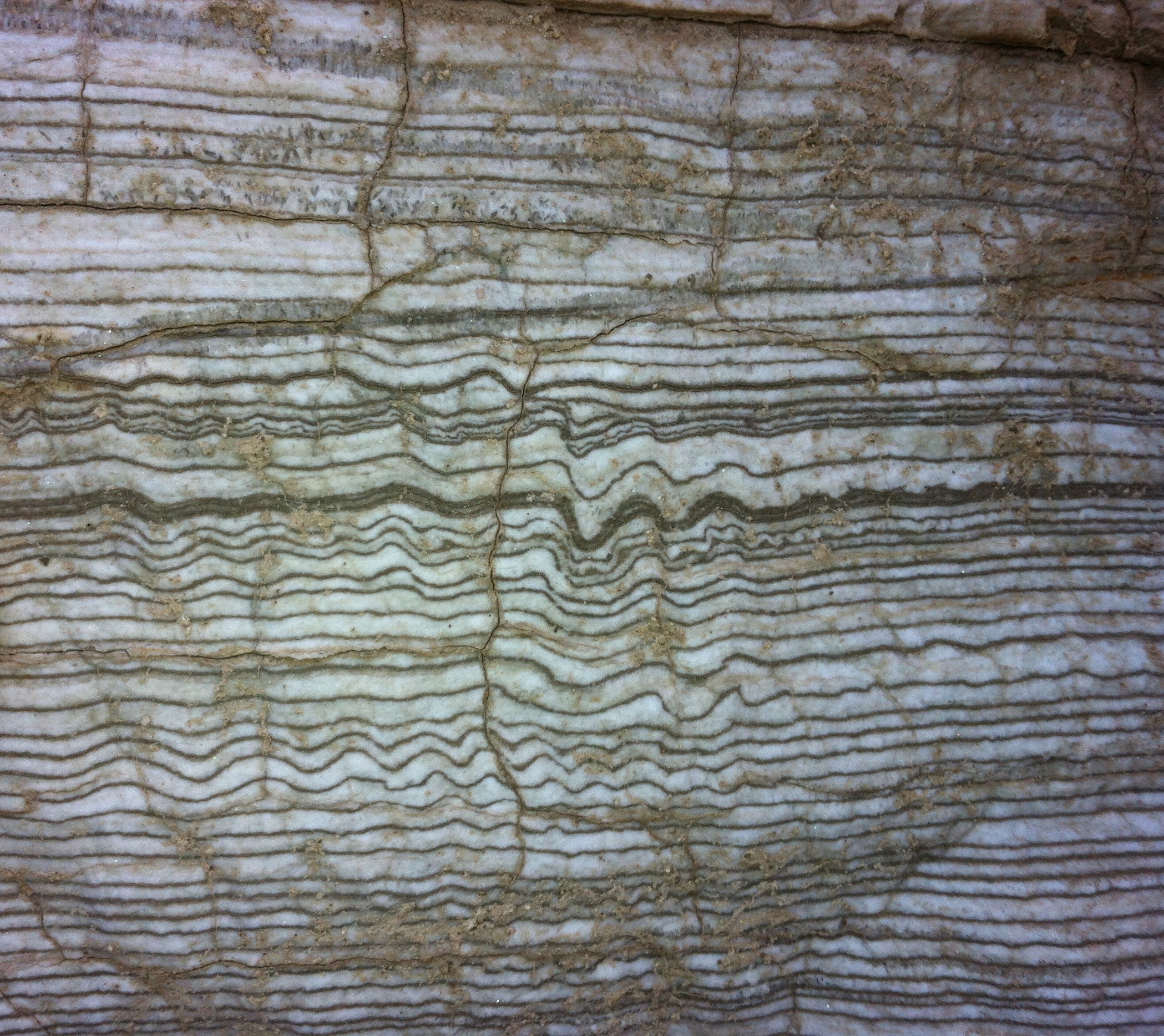
Castile Formation
Permian evaporites from the Delaware Basin near Carlsbad NM. Photo Brian Hunt.
Comanche Springs
Once perennial, now intermittent spring due to upgradient pumping of groundwater, Ft. Stockton, West Texas. Photo by Brian Hunt.
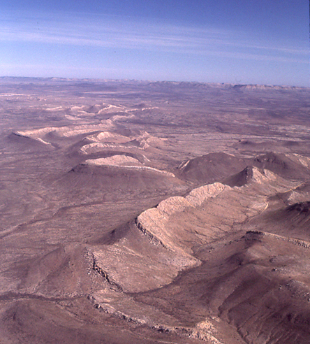
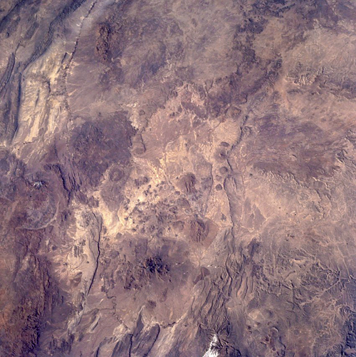
Big Bend, West Texas
View to N from the Rio Grande into the Davis Mts. volcanic field (top right): Mariscal-San Vicente Mt. (butterfly shaped), Chisos Mts. (rugged, dark red-brown), Marathon Basin (crenulated margin). (NASA-JSC, Space Shuttle photo STS60-85-08)
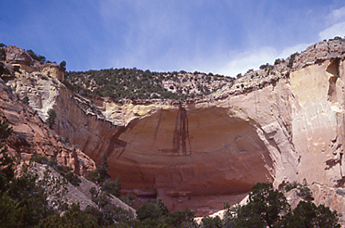
Echo Amphitheater near Abiquiu, NM.
Waterfall plunge pool eroded into red, cream and gold Entrada dune sandstones (L. Jurassic), which overile red fluvial mudstones of the Chinle Fm (Triassic) and underlie gray lacustrine evaporites of the Todilto Fm (M. Jurassic). (Patricia Dickerson)
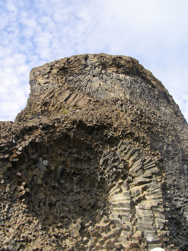
Hljodaklettar, Iceland.
Columnar basalt, with spectacular radiating columns, is estimated to be 10,000-12,000 years old; magma may have been sourced from the Krafla volcanic system. (Patricia Dickerson)
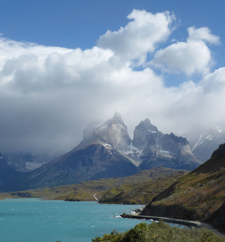
Torres del Paine National Park, Chilean Patagonia
Miocene layered granite massif (tan) with roof pendant of Cretaceous deep-marine metasediments (brownish black). (Patricia Dickerson)